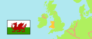
Country
The population development of Wales according to census results and latest official estimates.
| Name | Abbr. | Status | Capital | Area A (km²) | Population Census (C) 1991-04-05 | Population Census (C) 2001-04-29 | Population Census (C) 2011-03-27 | Population Census (C) 2021-03-21 | Population Estimate (E) 2024-06-30 | ||
|---|---|---|---|---|---|---|---|---|---|---|---|
| Wales (Cymru) | WAL | Cntry | Cardiff | 20,735 | 2,835,073 | 2,903,085 | 3,063,456 | 3,107,494 | 3,186,581 | 2073500 | → |
| United Kingdom | GBR | Kingd | London | 242,500 | 56,466,680 | 58,789,194 | 63,182,178 | 66,920,000 | 69,281,437 | → |
- UK Office for National Statistics.
Major Urban Areas
| Name | Adm. | Population Census (C) 2021-03-21 | |
|---|---|---|---|
| 1 | Cardiff | WAL | 464,635 |
| 2 | Newport | WAL | 318,852 |
| 3 | Swansea | WAL | 299,871 |
| 4 | Bridgend | WAL | 66,749 |
| 5 | Wrexham | WAL | 65,200 |
| 6 | Buckley | WAL | 62,951 |
| 7 | Tonypandy | WAL | 61,545 |
| 8 | Barry | WAL | 56,587 |
Contents: Urban Areas
The population of all Welsh urban areas (i.e. more or less continuously built-up areas) with more than 15,000 inhabitants.
| Name | Adm. | Population Census (C) 2001-04-29 | Population Census (C) 2011-03-27 | Population Census (C) 2021-03-21 | Area | |
|---|---|---|---|---|---|---|
| Aberdare | WAL | 36,175 | 36,160 | 37,691 | 1022 | |
| Abergavenny | WAL | 14,055 | 14,651 | 15,697 | 489 | → |
| Aberystwyth | WAL | 16,593 | 18,749 | 16,413 | 504 | |
| Ammanford | WAL | 20,450 | 22,750 | 24,375 | 1289 | |
| Bangor | WAL | 15,215 | 17,844 | 17,324 | 528 | → |
| Barry (Barri) | WAL | 50,952 | 54,673 | 56,587 | 1581 | → |
| Bridgend | WAL | 52,090 | 60,270 | 66,749 | 2144 | |
| Buckley | WAL | 60,336 | 62,608 | 62,951 | 2420 | |
| Cardiff | WAL | 403,974 | 447,516 | 464,635 | 10856 | |
| Carmarthen | WAL | 14,841 | 15,799 | 16,460 | 604 | → |
| Chepstow | WAL | 13,908 | 15,629 | 15,554 | 579 | |
| Church Village | WAL | 21,074 | 21,952 | 22,103 | 546 | |
| Colwyn Bay | WAL | 31,867 | 34,284 | 33,887 | 1019 | |
| Conwy | WAL | 14,208 | 14,723 | 15,725 | 558 | → |
| Ebbw Vale | WAL | 35,122 | 35,143 | 33,983 | 1113 | |
| Flint | WAL | 25,601 | 26,178 | 26,814 | 926 | |
| Gorseinon | WAL | 19,388 | 20,695 | 22,323 | 654 | |
| Haverfordwest | WAL | 13,184 | 14,128 | 14,304 | 682 | → |
| Kinmel Bay (incl. Abergele) | WAL | 17,295 | 18,440 | 18,877 | 721 | → |
| Llandudno | WAL | 14,872 | 15,371 | 14,709 | 404 | → |
| Llanelli | WAL | 45,676 | 49,067 | 49,486 | 1612 | |
| Llantrisant | WAL | 12,240 | 14,422 | 14,549 | 461 | |
| Llantwit Major | WAL | 13,940 | 14,384 | 14,110 | 576 | |
| Maesteg | WAL | 20,891 | 20,806 | 20,134 | 507 | |
| Merthyr Tydfil | WAL | 40,749 | 43,544 | 43,316 | 1238 | → |
| Milford Haven | WAL | 12,812 | 13,533 | 14,249 | 900 | → |
| Newport | WAL | 291,133 | 305,774 | 318,852 | 9646 | |
| Porthcawl | WAL | 15,640 | 15,672 | 15,798 | 498 | → |
| Pyle | WAL | 12,464 | 13,701 | 14,080 | 388 | → |
| Rhosllannerchrugog | WAL | 23,762 | 24,944 | 24,488 | 769 | |
| Rhyl | WAL | 46,023 | 45,710 | 47,714 | 1378 | |
| Swansea | WAL | 281,857 | 298,637 | 299,871 | 9838 | |
| Tonypandy (Rhondda) | WAL | 64,835 | 62,636 | 61,545 | 1293 | |
| Tredegar | WAL | 14,802 | 14,855 | 14,529 | 535 | → |
| Wrexham | WAL | 61,449 | 65,540 | 65,200 | 1784 |
- All population figures and depicted boundaries are based on output areas officially assigned to the 2022 built-up areas and combined like the 2011 built-up areas. Output areas often include some unbuilt parts. However, tabulated area figures refer to (typically smaller) actual built-up areas in order to present a more realistic population density. Some of the 2001 figures are approximate values.
- UK Office for National Statistics.
