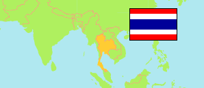
Chaiyaphum
Province in Northeastern Region
Province
The population development of Chaiyaphum.
| Name | Native | Status | Population Estimate 2005-12-31 | Population Estimate 2010-12-31 | Population Estimate 2015-12-31 | Population Estimate 2019-12-31 | |
|---|---|---|---|---|---|---|---|
| Chaiyaphum | จังหวัดชัยภูมิ | Province | 1,116,934 | 1,127,423 | 1,138,252 | 1,138,777 | → |
| Northeastern | ภาคตะวันออกเฉียงเหนือ | Planning Region | 21,328,111 | 21,573,318 | 21,916,034 | 22,015,239 |
Contents: Municipalities
The population development of the municipalities in Chaiyaphum.
| Name | Native | Status | Province | Population Estimate 2005-12-31 | Population Estimate 2010-12-31 | Population Estimate 2015-12-31 | Population Estimate 2019-12-31 | |
|---|---|---|---|---|---|---|---|---|
| Bamnet Narong | บำเหน็จณรงค์ | Commune | Chaiyaphum | 7,625 | 7,430 | 7,306 | 7,147 | → |
| Ban Duea | บ้านเดื่อ | Commune | Chaiyaphum | 15,284 | 15,025 | 15,342 | 15,524 | → |
| Ban Khai Muen Phaeo | บ้านค่ายหมื่นแผ้ว | Commune | Chaiyaphum | 5,411 | 5,287 | 5,232 | 5,041 | → |
| Ban Khwao | บ้านเขว้า | Commune | Chaiyaphum | 8,620 | 8,541 | 8,362 | 8,127 | → |
| Ban Pao | บ้านเป้า | Commune | Chaiyaphum | 8,217 | 8,107 | 7,957 | 7,810 | → |
| Ban Phet | บ้านเพชร | Commune | Chaiyaphum | 5,614 | 5,478 | 5,365 | 5,153 | → |
| Ban Phet Phu Khiao | บ้านเพชรภูเขียว | Commune | Chaiyaphum | 5,770 | 5,816 | 5,734 | 5,743 | → |
| Ban Thaen | บ้านแท่น | Commune | Chaiyaphum | 4,029 | 4,304 | 4,246 | 4,091 | → |
| Chaiyaphum | ชัยภูมิ | Town | Chaiyaphum | 37,512 | 37,510 | 36,817 | 36,067 | → |
| Chatturat | จัตุรัส | Commune | Chaiyaphum | 4,375 | 4,405 | 4,257 | 4,219 | → |
| Huai Yang | ห้วยยาง | Commune | Chaiyaphum | 15,672 | 15,191 | 15,385 | 15,470 | → |
| Kaeng Khro | แก้งคร้อ | Commune | Chaiyaphum | 9,546 | 9,370 | 9,025 | 8,738 | → |
| Kaset Sombun | เกษตรสมบูรณ์ | Commune | Chaiyaphum | 3,263 | 3,228 | 3,140 | 2,991 | → |
| Khon San | คอนสาร | Commune | Chaiyaphum | 4,558 | 4,431 | 4,371 | 4,310 | → |
| Khon Sawan | คอนสวรรค์ | Commune | Chaiyaphum | 4,566 | 4,454 | 4,482 | 4,398 | → |
| Lat Yai | ลาดใหญ่ | Commune | Chaiyaphum | 4,896 | 4,781 | 4,707 | 4,671 | → |
| Na Nong Thum | นาหนองทุ่ม | Commune | Chaiyaphum | 11,365 | 11,439 | 11,207 | 10,986 | → |
| Nong Bua Daeng | หนองบัวแดง | Commune | Chaiyaphum | 9,177 | 9,343 | 9,197 | 8,954 | → |
| Nong Bua Khok | หนองบัวโคก | Commune | Chaiyaphum | 2,034 | 2,048 | 1,993 | 2,000 | → |
| Nong Bua Rawe | หนองบัวระเหว | Commune | Chaiyaphum | 5,574 | 5,835 | 5,918 | 5,936 | → |
| Phu Khiao | ภูเขียว | Commune | Chaiyaphum | ... | 7,029 | 6,897 | 6,450 | → |
| Thep Sathit | เทพสถิต | Commune | Chaiyaphum | 4,067 | 4,051 | 4,019 | 3,996 | → |
Source: Department of Provincial Administration, Official Statistics Registration Systems (web).
Explanation: The registered population differs strongly from the results of the 2010 census.
