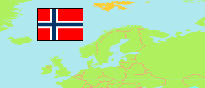
Svalbard is an external, unincorporated territorium of the Kingdom of Norway.
Archipelagos
The population of the archipelagos of Svalbard according to official estimates.
| Name | Abbr. | Area A (km²) | Population Estimate (E) 1998-01-01 | Population Estimate (E) 2004-07-01 | Population Estimate (E) 2010-07-01 | Population Estimate (E) 2015-07-01 | Population Estimate (E) 2020-07-01 | Population Estimate (E) 2025-07-01 | ||
|---|---|---|---|---|---|---|---|---|---|---|
| Bjørnøya [Bear Island] | BJO | 178 | 8 | 9 | 9 | 9 | 9 | 9 | 17800 | |
| Hopen | HOP | 47 | 4 | 4 | 4 | 4 | 4 | 4 | 4700 | |
| Svalbard (Spitsbergen) | SPI | 60,797 | 2,989 | 2,693 | 2,529 | 2,667 | 2,884 | 2,881 | 6079700 | |
| Svalbard | SVA | 61,022 | 3,001 | 2,706 | 2,542 | 2,680 | 2,897 | 2,894 |
- The population of Bear Island and Hopen consists only of the crews of meteorological stations.
- (1998) (2004) provided by Celvin Ruisdael.
(2010) (2015) (2020) (2025) Statistics Norway, other web resources.
Contents: Settlements and Stations
The population of the settlements and stations of Svalbard according to official and unofficial estimates.
| Name | Status | Adm. | Population Estimate (E) 1998-01-01 | Population Estimate (E) 2004-07-01 | Population Estimate (E) 2010-07-01 | Population Estimate (E) 2015-07-01 | Population Estimate (E) 2020-07-01 | Population Estimate (E) 2025-07-01 | Area |
|---|---|---|---|---|---|---|---|---|---|
| Barentsburg [Russian settlement] | ASett | SPI | 791 | 812 | 449 | 468 | 455 | 343 | 0 |
| Herwighamna | Stat | BJO | 8 | 9 | 9 | 9 | 9 | 9 | 0 |
| Hopen Radio | Stat | HOP | 4 | 4 | 4 | 4 | 4 | 4 | 0 |
| Isbjørnhamna (Hornsund) [Polish Polar Station] | ASett | SPI | 10 | 8 | 9 | 10 | 10 | 10 | 0 |
| Isfjord Radio | Stat | SPI | 2 | 0 | 0 | 0 | 0 | 0 | 0 |
| Longyearbyen [Norwegian settlement] | Sett | SPI | 1,698 | 1,831 | 1,970 | 2,060 | 2,290 | 2,410 | 0 |
| Ny-Ålesund [Norwegian settlement] | Sett | SPI | 27 | 33 | 100 | 130 | 130 | 115 | 0 |
| Pyramiden [Russian settlement] | ASett | SPI | 451 | 0 | ... | ... | ... | ... | 0 |
| Svea (Sveagruva) | Sett | SPI | 7 | 9 | ... | ... | 0 | 0 | 0 |
- The total mid-2025 population of Norwegian settlements were estimated as 2,528. Norwegian inhabitants of Norwegian settlements (1,661 in 2025) are registered as residents of a Norwegian municipality.
- The coal mine in Svea stopped production in April 2016; the settlement was officially closed in 2020.
- The population tabulated for Barentsburg includes Pyramiden. Pyramiden was closed as mining settlement in 1998; in 2013 a hotel was opend. Some Russian settlers work in Pyramiden maintaining the infrastructure, running the hotel and guiding touristic tours.
- (1998) (2004) provided by Celvin Ruisdael.
(2010) (2015) (2020) (2025) Statistics Norway, other web resources.
