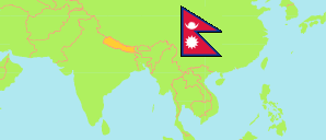
Rautahat
District in Nepal
Contents: Population
The population development of Rautahat as well as related information and services (Wikipedia, Google, images).
| Name | Status | Transcription | Native | Population Census 1981-06-22 | Population Census 1991-06-22 | Population Census 2001-05-28 | Population Census 2011-06-22 | Population Census 2021-11-25 | |||||||||||
|---|---|---|---|---|---|---|---|---|---|---|---|---|---|---|---|---|---|---|---|
| Rautahat | District | Rautahaṭa | रौतहट जिल्ला | 332,526 | 414,005 | 545,132 | 686,722 | 813,573 | |||||||||||
Rautahat 813,573 Population [2021] – Census 1,126 km² Area 722.5/km² Population Density [2021] 1.6% Annual Population Change [2011 → 2021] | |||||||||||||||||||
| Nepal | Federal Republic | Nēpāla | नेपाल | 15,022,839 | 18,491,097 | 23,151,423 | 26,494,504 | 29,164,578 | |||||||||||
Source: Central Bureau of Statistics Nepal (web).
Further information about the population structure:
| Gender (C 2021) | |
|---|---|
| Males | 408,403 |
| Females | 405,170 |
| Age Groups (C 2021) | |
|---|---|
| 0-14 years | 298,922 |
| 15-64 years | 467,400 |
| 65+ years | 47,251 |
| Age Distribution (C 2021) | |
|---|---|
| 90+ years | 958 |
| 80-89 years | 4,117 |
| 70-79 years | 24,362 |
| 60-69 years | 36,819 |
| 50-59 years | 52,468 |
| 40-49 years | 75,085 |
| 30-39 years | 99,223 |
| 20-29 years | 135,648 |
| 10-19 years | 183,384 |
| 0-9 years | 201,509 |
| Citizenhip (C 2021) | |
|---|---|
| Nepal | 811,534 |
| India | 2,026 |
| Other country | 13 |
| Place of Birth (C 2021) | |
|---|---|
| Same local unit | 653,685 |
| Other local unit in same district | 82,761 |
| Other district | 50,387 |
| Other country | 26,666 |
| Literacy (A5+) (C 2021) | |
|---|---|
| Yes | 413,631 |
| Only reading | 2,387 |
| No | 300,155 |
