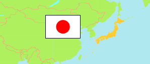
Kitagunma
District (-gun) in Gumma (Japan)
Contents: Population
The population development of Kitagunma as well as related information and services (Wikipedia, Google, images).
| Name | Status | Native | Population Census 1995-10-01 | Population Census 2000-10-01 | Population Census 2005-10-01 | Population Census 2010-10-01 | Population Census 2015-10-01 | Population Census 2020-10-01 | |
|---|---|---|---|---|---|---|---|---|---|
| Kitagunma | District (-gun) | 北群馬郡 | 27,722 | 29,838 | 32,218 | 34,171 | 35,409 | 36,008 | |
| Nippon [Japan] | State | 日本国 | 125,570,246 | 126,925,843 | 127,767,994 | 128,057,352 | 127,094,745 | 126,146,099 |
Source: Statistics Bureau Japan (web).
Further information about the population structure:
| Gender (C 2020) | |
|---|---|
| Males | 17,803 |
| Females | 18,205 |
| Age Groups (C 2020) | |
|---|---|
| 0-17 years | 6,387 |
| 18-64 years | 20,525 |
| 65+ years | 8,988 |
| Age Distribution (C 2020) | |
|---|---|
| 90+ years | 540 |
| 80-89 years | 2,025 |
| 70-79 years | 4,052 |
| 60-69 years | 4,444 |
| 50-59 years | 4,427 |
| 40-49 years | 5,629 |
| 30-39 years | 4,409 |
| 20-29 years | 3,297 |
| 10-19 years | 3,640 |
| 0-9 years | 3,437 |
| Citizenship (C 2020) | |
|---|---|
| Japan | 35,624 |
| Foreign Citizenship | 306 |