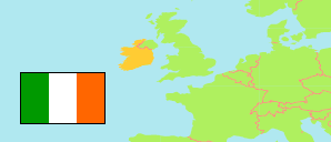
Rosslare (Ireland)
Contents: Census Town
The population development of Rosslare as well as related information and services (weather, Wikipedia, Google, images).
| Name | County | Population Census 1991-04-21 | Population Census 1996-04-28 | Population Census 2002-04-28 | Population Census 2006-04-23 | Population Census 2011-04-10 | Population Census 2016-04-24 | Population Census 2022-04-03 | |
|---|---|---|---|---|---|---|---|---|---|
| Rosslare | Wexford | 847 | 929 | 1,145 | 1,359 | 1,547 | 1,620 | 1,795 | → |
Source: Central Statistics Office, Ireland.
Further information about the population structure:
| Gender (C 2022) | |
|---|---|
| Males | 831 |
| Females | 964 |
| Age Groups (C 2022) | |
|---|---|
| 0-17 years | 417 |
| 18-64 years | 941 |
| 65+ years | 437 |
| Age Distribution (C 2022) | |
|---|---|
| 80+ years | 107 |
| 70-79 years | 208 |
| 60-69 years | 233 |
| 50-59 years | 243 |
| 40-49 years | 233 |
| 30-39 years | 186 |
| 20-29 years | 131 |
| 10-19 years | 235 |
| 0-9 years | 219 |
| Country of Birth (C 2022) | |
|---|---|
| Ireland | 1,463 |
| Other country | 332 |