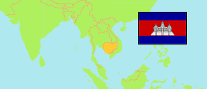
Russey Keo
City District in Cambodia
Contents: Subdivision
The population development in Russey Keo as well as related information and services (Wikipedia, Google, images).
| Name | Status | Native | Population Census 1998-03-03 | Population Census 2008-03-03 | Population Census 2019-03-03 | |
|---|---|---|---|---|---|---|
| Russey Keo | City District | ឫស្សីកែវ | 91,239 | 135,470 | 274,861 | |
| Chrang Chamreh Ti Muoy | Urban Commune | ច្រាំងចំរេះទី ១ | 7,233 | 9,948 | 22,911 | → |
| Chrang Chamreh Ti Pir | Urban Commune | ច្រាំងចំរេះទី ២ | 12,451 | 14,282 | 25,302 | → |
| Kilomaetr Lekh Prammuoy | Urban Commune | គីឡូម៉ែត្រលេខ៦ | 13,372 | 17,266 | 23,641 | → |
| Ruessei Kaev | Urban Commune | ឫស្សីកែវ | 18,742 | 24,960 | 57,873 | → |
| Svay Pak | Urban Commune | ស្វាយប៉ាក | 12,197 | 16,446 | 19,042 | → |
| Tuol Sangkae [incl. Tuol Sangkae Ti Muoy, Tuol Sangkae Ti Pir] | Urban Commune | ទួលសង្កែ | 27,244 | 52,568 | 126,092 | → |
| Phnum Pénh [Phnom Penh] | Province-level Municipality | រាជធានីភ្នំពេញ | 1,133,430 | 1,501,725 | 2,281,951 |
Source: National Institute of Statistics of Cambodia (web).
Explanation: The result of the 2019 census represents the de facto population of Cambodia. It excludes migrants working abroad. The 2019 figures for districts and communes refer only to household population; they exclude institutional, boat and transient population, i.e. 4.01% of the total population of Phnom Penh is missing in addition.