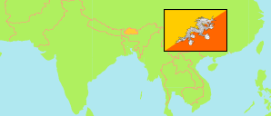
Sarpang
District in Bhutan
Contents: Subdivision
The population development in Sarpang as well as related information and services (Wikipedia, Google, images).
| Name | Status | Population Census 2005-05-31 | Population Census 2017-05-30 | |
|---|---|---|---|---|
| Sarpang (Geylegphug) | District | 37,191 | 46,004 | |
| Chhudzom (Doban) | Gewog | 2,064 | 2,664 | → |
| Chhuzanggang (Chhuzagang) | Gewog | 2,426 | 2,499 | → |
| Dekiling | Gewog | 3,835 | 5,980 | → |
| Gakiling (Hiley) | Gewog | 2,517 | 2,125 | → |
| Gelegphu (Gelephu) | Gewog | 13,174 | 16,315 | → |
| Jigme Chhoeling (Jigmechhoeling) | Gewog | 3,504 | 3,258 | → |
| Samtenling (Bhur) | Gewog | 1,517 | 2,801 | → |
| Senggey (Senge, Senghe) | Gewog | 742 | 1,080 | → |
| Serzhong (Sherzhong) | Gewog | 2,045 | 2,707 | → |
| Shompangkha | Gewog | 3,749 | 4,638 | → |
| Tareythang (Taklai) | Gewog | 72 | 351 | → |
| Umling | Gewog | 1,546 | 1,586 | → |
| Druk Yul [Bhutan] | Kingdom | 634,982 | 727,145 |
Source: National Statistics Bureau, Royal Government of Bhutan (web).
Explanation: The population figures of towns and municipalities are generally assigned to an adjacent gewog. Area figures of gewogs are computed by using geospatial data.
Further information about the population structure:
| Gender (C 2017) | |
|---|---|
| Males | 24,018 |
| Females | 21,986 |
| Age Groups (C 2017) | |
|---|---|
| 0-14 years | 11,215 |
| 15-64 years | 32,177 |
| 65+ years | 2,612 |
| Age Distribution (C 2017) | |
|---|---|
| 0-9 years | 6,928 |
| 10-19 years | 8,974 |
| 20-29 years | 9,499 |
| 30-39 years | 7,766 |
| 40-49 years | 5,199 |
| 50-59 years | 3,546 |
| 60-69 years | 2,429 |
| 70+ years | 1,663 |
| Urbanization (C 2017) | |
|---|---|
| Rural | 32,994 |
| Urban | 13,010 |
