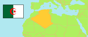
El Ghicha
Commune in Laghouat (Algeria)
Contents: Population
The population development of El Ghicha as well as related information and services (Wikipedia, Google, images).
| Name | Status | Native | Population Census 1998-06-25 | Population Census 2008-04-14 | |
|---|---|---|---|---|---|
| El Ghicha | Commune | الغيشة | 5,719 | 6,079 | |
| Algérie [Algeria] | Republic | الجزائر | 29,100,867 | 34,080,030 |
Source: Office National des Statistiques de l'Algérie (web).
Further information about the population structure:
| Gender (C 2008) | |
|---|---|
| Males | 3,072 |
| Females | 3,007 |
| Age Groups (C 2008) | |
|---|---|
| 0-14 years | 1,906 |
| 15-64 years | 3,852 |
| 65+ years | 314 |
| Age Distribution (C 2008) | |
|---|---|
| 0-9 years | 1,227 |
| 10-19 years | 1,451 |
| 20-29 years | 1,322 |
| 30-39 years | 833 |
| 40-49 years | 509 |
| 50-59 years | 312 |
| 60-69 years | 219 |
| 70-79 years | 150 |
| 80+ years | 49 |
| Clustering (C 2008) | |
|---|---|
| in main locality | 3,596 |
| in other settlements | 2,184 |
| scattered | 299 |
