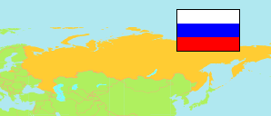
Šar'ja
Urban District in Kostroma Oblast
Urban District
The population development of Šar'ja.
| Name | Native | Status | Population Census 2002-10-09 | Population Census 2010-10-14 | Population Census 2021-10-01 | |
|---|---|---|---|---|---|---|
| Šar'ja [Sharya] | Городской округ город Шарья | Urban District | 39,365 | 36,659 | 30,739 | → |
| Kostroma Oblast | Костромская область | Region | 736,641 | 667,562 | 580,976 |
Contents: Urban and Rural Places
The population development of the urban and rural places in Šar'ja.
| Name | Native | Status | District | Population Census 2002-10-09 | Population Census 2010-10-14 | Population Census 2021-10-01 | |
|---|---|---|---|---|---|---|---|
| Šar'ja [Sharya] | Шарья | City | Šar'ja | 24,900 | 23,681 | 20,439 | → |
| Vetlužskij [Vetluzhsky] | Ветлужский | Urban Settlement | Šar'ja | 13,576 | 12,224 | 9,548 | → |
Source: Federal State Statistics Service Russia (web), pop-stat.mashke.org.