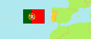
Braga (Portugal)
District
The population development of Braga.
| Name | Status | Population Census 2001-03-12 | Population Census 2011-03-21 | Population Census 2021-03-22 | |
|---|---|---|---|---|---|
| Braga | District | 831,366 | 848,185 | 846,293 | → |
| Portugal | Republic | 10,356,117 | 10,562,178 | 10,343,066 |
Contents: Urban Areas
The population development of the urban areas in Braga.
| Name | Status | District / Region | Population Census 2001-03-12 | Population Census 2011-03-21 | Population Census 2021-03-22 | |
|---|---|---|---|---|---|---|
| Amares | Urban Area | Braga | 6,480 | 7,227 | 7,495 | → |
| Arco de Baúlhe | Urban Area | Braga | 2,178 | 2,048 | 1,950 | → |
| Aves (Serzedelo e Guardizela) | Urban Area | Braga | 6,574 | 6,104 | 5,865 | → |
| Balugães | Urban Area | Braga | 863 | 841 | 787 | → |
| Barcelos | Urban Area | Braga | 47,041 | 46,880 | 46,678 | → |
| Braga | Urban Area | Braga | 145,230 | 163,122 | 175,834 | → |
| Cabeceiras de Basto | Urban Area | Braga | 6,428 | 6,755 | 6,574 | → |
| Esposende | Urban Area | Braga | 33,325 | 34,254 | 35,132 | → |
| Fafe | Urban Area | Braga | 25,124 | 25,647 | 25,217 | → |
| Guimarães | Urban Area | Braga | 118,821 | 119,135 | 118,346 | → |
| Joane | Urban Area | Braga | 11,482 | 12,266 | 11,999 | → |
| Lago | Urban Area | Braga | 1,955 | 1,910 | 1,824 | → |
| Lousado | Urban Area | Braga | 12,023 | 12,885 | 12,945 | → |
| Martim | Urban Area | Braga | 2,411 | 2,375 | 2,051 | → |
| Póvoa de Lanhoso | Urban Area | Braga | 4,602 | 5,048 | 5,623 | → |
| Riba de Ave | Urban Area | Braga | 33,645 | 33,832 | 32,192 | → |
| Taipas (Caldas das Taipas) | Urban Area | Braga | 10,836 | 10,987 | 11,249 | → |
| Vila Nova de Famalicão | Urban Area | Braga | 53,574 | 57,474 | 58,883 | → |
| Vila Verde | Urban Area | Braga | 14,684 | 17,312 | 17,882 | → |
| Vizela | Urban Area | Braga | 22,595 | 23,736 | 23,896 | → |
Source: Instituto Nacional de Estatística Portugal (web).
Explanation: The territorial units consist of predominant urban parishes (freguesias) as defined by TIPAU 2014 (Tipologia de Áreas Urbanas). The tabulated population figures are computed by »City Population«.