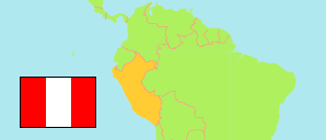
General Sánchez Cerro
Province in Moquegua Region
Province
The population development of General Sánchez Cerro.
| Name | Status | Population Census 2007-10-21 | Population Census 2017-10-22 | |
|---|---|---|---|---|
| General Sánchez Cerro | Province | 24,904 | 16,012 | → |
| Moquegua | Region | 161,533 | 182,017 |
Contents: Localities
The population development of the localities in General Sánchez Cerro.
| Name | Status | Province | Population Census 2007-10-21 | Population Census 2017-10-22 | |
|---|---|---|---|---|---|
| Anascapa | Locality | General Sánchez Cerro | ... | 203 | → |
| Chacahuayo | Locality | General Sánchez Cerro | ... | 255 | → |
| Challahuayo | Urban Locality | General Sánchez Cerro | ... | 255 | → |
| Chilata | Locality | General Sánchez Cerro | ... | 231 | → |
| Chojata | Main Locality | General Sánchez Cerro | ... | 335 | → |
| Coalaque | Main Locality | General Sánchez Cerro | ... | 385 | → |
| Cogri | Urban Locality | General Sánchez Cerro | ... | 691 | → |
| Ichuña | Main Locality | General Sánchez Cerro | ... | 905 | → |
| La Capilla | Main Locality | General Sánchez Cerro | ... | 135 | → |
| Lloque | Main Locality | General Sánchez Cerro | ... | 319 | → |
| Luque (Luco) | Locality | General Sánchez Cerro | ... | 211 | → |
| Matalaque | Main Locality | General Sánchez Cerro | ... | 197 | → |
| Omate | Urban Main Locality | General Sánchez Cerro | ... | 1,049 | → |
| Puquina | Main Locality | General Sánchez Cerro | ... | 865 | → |
| Quinistacas | Urban Locality | General Sánchez Cerro | ... | 366 | → |
| Quinistaquillas | Main Locality | General Sánchez Cerro | ... | 356 | → |
| Salinas Moche | Locality | General Sánchez Cerro | ... | 250 | → |
| Santa Cruz de Oyo Oyo (Santa Cruz) | Locality | General Sánchez Cerro | ... | 251 | → |
| Ubinas | Main Locality | General Sánchez Cerro | ... | 325 | → |
| Yalagua | Locality | General Sánchez Cerro | ... | 231 | → |
| Yunga | Main Locality | General Sánchez Cerro | ... | 590 | → |
Source: Instituto Nacional de Estadística e Informática, Peru (web).
Explanation: In case of the region, provinces and urban (main) localities, the tabulated results of the 2017 census are adjusted for underenumeration.