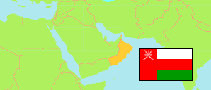
Khaṣab
District in Musandam Governorate
District
The population development of Khaṣab.
| Name | Native | Status | Population Census 2003-12-07 | Population Census 2010-12-12 | Population Census 2020-12-12 | |
|---|---|---|---|---|---|---|
| Khaṣab | خصب | District | 17,730 | 18,151 | 29,688 | → |
| Musandam | مسندم | Governorate | 28,378 | 31,425 | 49,062 |
Contents: Localities
The population development of the localities in Khaṣab.
| Name | Native | Status | District | Population Census 2003-12-07 | Population Census 2010-12-12 | Population Census 2020-12-12 | |
|---|---|---|---|---|---|---|---|
| Alfatk | الفتك | Locality | Khaṣab | 40 | 48 | 57 | → |
| Al-Habaylah | الحبيلة | Locality | Khaṣab | 64 | 65 | 203 | → |
| Al-Haqat | الحقت | Locality | Khaṣab | 0 | 0 | 184 | → |
| Al-Harf | الحرف | Locality | Khaṣab | 497 | 520 | 699 | → |
| Al-Qatayn | القطين | Locality | Khaṣab | 74 | 9 | 177 | → |
| Ash-Sharjah | الشرجة | Locality | Khaṣab | 134 | 61 | 89 | → |
| As-Silyan | السليان | Locality | Khaṣab | 77 | 80 | 111 | → |
| Birkat an-Nuss | بركة النص | Locality | Khaṣab | 24 | 70 | 118 | → |
| Ghibannah | غبنة | Locality | Khaṣab | 81 | 64 | 150 | → |
| Hajir Nasib | حاجرناصب | Locality | Khaṣab | 20 | 9 | 64 | → |
| Khasab | خصب | Locality | Khaṣab | 12,049 | 12,069 | 21,651 | → |
| Khizaynuh | خزينوة | Locality | Khaṣab | 9 | 12 | 152 | → |
| Kumzar | كمزار | Locality | Khaṣab | 1,412 | 1,378 | 1,418 | → |
| Lima | ليماء | Locality | Khaṣab | 1,497 | 1,409 | 2,067 | → |
| Qada | قـدى | Locality | Khaṣab | 390 | 440 | 473 | → |
| Qubbah | قبة | Locality | Khaṣab | 22 | 4 | 63 | → |
| Ras Hafif | راس حفيف | Locality | Khaṣab | 0 | 0 | 66 | → |
| Sall Ala | سل أعلى | Locality | Khaṣab | ... | 68 | 119 | → |
| Sall Asfal | سل أسفل | Locality | Khaṣab | 186 | 202 | 316 | → |
| Sawi | صاوي | Locality | Khaṣab | 48 | 48 | 99 | → |
| Sayma | سيما | Locality | Khaṣab | 47 | 102 | 334 | → |
| Shisah | شيصة | Locality | Khaṣab | 44 | 53 | 79 | → |
| Sibi | صيبي | Locality | Khaṣab | 59 | 67 | 72 | → |
| Wadi Muwwah / Muwwah | وادي موة / موة | Locality | Khaṣab | 97 | 122 | 90 | → |
Source: Sultanate of Oman, National Centre for Statistics and Information (web).
Explanation: The 2020 census was organized as an electronic census.