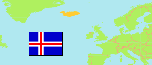
Rangárþing ytra (Iceland)
Municipality
The population development of Rangárþing ytra.
| Name | Status | Population Estimate 2000-01-01 | Population Estimate 2005-01-01 | Population Estimate 2010-01-01 | Population Estimate 2015-01-01 | Population Estimate 2020-01-01 | Population Estimate 2024-01-01 | |
|---|---|---|---|---|---|---|---|---|
| Rangárþing ytra | Municipality | 1,378 | 1,446 | 1,543 | 1,519 | 1,644 | 1,867 | → |
| Ísland [Iceland] | Country | 279,049 | 293,577 | 317,630 | 323,024 | 354,042 | 383,726 |
Contents: Urban Localities
The population development of the urban localities in Rangárþing ytra.
| Name | Status | Municipality | Population Estimate 2000-01-01 | Population Estimate 2005-01-01 | Population Estimate 2010-01-01 | Population Estimate 2015-01-01 | Population Estimate 2020-01-01 | Population Estimate 2024-01-01 | |
|---|---|---|---|---|---|---|---|---|---|
| Hella | Urban Settlement | Rangárþing ytra | 604 | 696 | 799 | 823 | 871 | 1,015 | → |
| Þykkvibær (Byggðakjarni í Þykkvabæ) | Urban Settlement | Rangárþing ytra | 129 | 106 | 89 | 64 | 75 | 77 | → |
Source: Statistics Iceland.