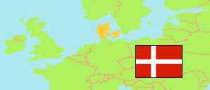
Struer
Municipality in Midtjylland
Municipality
The population development of Struer.
| Name | Status | Population Estimate 2006-01-01 | Population Estimate 2011-01-01 | Population Estimate 2016-01-01 | Population Estimate 2021-01-01 | Population Estimate 2022-01-01 | |
|---|---|---|---|---|---|---|---|
| Struer | Municipality | 22,695 | 22,190 | 21,474 | 20,808 | 20,802 | → |
| Midtjylland [Mid Jutland] | Region | 1,219,725 | 1,260,993 | 1,293,309 | 1,332,048 | 1,341,857 |
Contents: Urban Settlements
The population development of the urban settlements in Struer.
| Name | Status | Municipality | Population Estimate 2006-01-01 | Population Estimate 2011-01-01 | Population Estimate 2016-01-01 | Population Estimate 2021-01-01 | Population Estimate 2022-01-01 | |
|---|---|---|---|---|---|---|---|---|
| Asp | Urban Settlement | Struer | 366 | 352 | 352 | 348 | 358 | → |
| Bremdal | Urban Settlement | Struer | 1,822 | 1,884 | 1,775 | 1,688 | 1,693 | → |
| Hjerm | Urban Settlement | Struer | 1,141 | 1,131 | 1,114 | 1,101 | 1,098 | → |
| Humlum | Urban Settlement | Struer | 838 | 853 | 872 | 804 | 797 | → |
| Hvidbjerg | Urban Settlement | Struer | 1,214 | 1,208 | 1,140 | 1,089 | 1,069 | → |
| Linde | Urban Settlement | Struer | 375 | 402 | 407 | 391 | 379 | → |
| Resenstad | Urban Settlement | Struer | 284 | 285 | 281 | 295 | 298 | → |
| Struer | Urban Settlement | Struer | 10,957 | 10,572 | 10,415 | 10,175 | 10,129 | → |
| Uglev | Urban Settlement | Struer | 287 | 264 | 206 | 219 | 229 | → |
Source: Denmark Statistik (web).