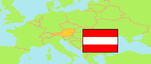
Kirchschlag bei Linz
Commune in Urfahr-Umgebung District
Commune
The population development of Kirchschlag bei Linz.
| Name | Status | Population Census 2001-05-15 | Population Census 2011-10-31 | Population Estimate 2023-01-01 | |
|---|---|---|---|---|---|
| Kirchschlag bei Linz | Commune | 1,903 | 2,021 | 2,224 | → |
Contents: Localities
The population development of the localities in Kirchschlag bei Linz.
| Name | Status | Commune | Population Census 2001-05-15 | Population Census 2011-10-31 | Population Estimate 2023-01-01 | |
|---|---|---|---|---|---|---|
| Davidschlag | Locality | Kirchschlag bei Linz | 250 | 274 | 328 | → |
| Eben | Locality | Kirchschlag bei Linz | 289 | 286 | 340 | → |
| Geitenedt | Locality | Kirchschlag bei Linz | 50 | 73 | 88 | → |
| Hochbuchedt | Locality | Kirchschlag bei Linz | 157 | 132 | 140 | → |
| Kirchschlag bei Linz | Locality | Kirchschlag bei Linz | 611 | 725 | 785 | → |
| Kronabittedt | Locality | Kirchschlag bei Linz | 23 | 25 | 23 | → |
| Riedl | Locality | Kirchschlag bei Linz | 212 | 209 | 233 | → |
| Rohrach | Locality | Kirchschlag bei Linz | 77 | 90 | 100 | → |
| Strich | Locality | Kirchschlag bei Linz | 95 | 87 | 82 | → |
| Wildberg | Locality | Kirchschlag bei Linz | 135 | 116 | 103 | → |
Source: Statistik Austria.
Explanation: Localities are defined independently of the type of settlement by municipal and state laws; they may be, e.g., closed settlements, scattered settlements or combinations thereof.