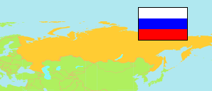
Armavir
Urban District in Krasnodar Krai
Urban District
The population development of Armavir.
| Name | Native | Status | Population Census 2002-10-09 | Population Census 2010-10-14 | Population Census 2021-10-01 | |
|---|---|---|---|---|---|---|
| Armavir | Городской округ город Армавир | Urban District | 211,824 | 208,103 | 206,809 | → |
| Krasnodar Kraj [Krasnodar Krai] | Краснодарский край | Territory | 5,125,221 | 5,226,647 | 5,838,273 |
Contents: Urban and Rural Places
The population development of the urban and rural places in Armavir.
| Name | Native | Status | District | Population Census 2002-10-09 | Population Census 2010-10-14 | Population Census 2021-10-01 | |
|---|---|---|---|---|---|---|---|
| Armavir | Армавир | City | Armavir | 193,964 | 188,832 | 187,177 | → |
| Krasnaja Poljana [Krasnaya Polyana] | Красная Поляна | Khutor | Armavir | 3,051 | 3,523 | 3,254 | → |
| Staraja Stanica [Staraya Stanitsa] | Старая Станица | Stanitsa | Armavir | 7,054 | 7,612 | 6,449 | → |
| Zavetnyj [Zavetny] | Заветный | Rural Settlement | Armavir | 4,429 | 4,854 | 5,996 | → |
Source: Federal State Statistics Service Russia (web), pop-stat.mashke.org.