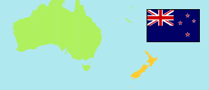
Nelson
Regional Council Area in South Island
Regional Council Area
The population development of Nelson.
| Name | Status | Population Estimate 1996-06-30 | Population Estimate 2001-06-30 | Population Estimate 2006-06-30 | Population Estimate 2013-06-30 | Population Estimate 2018-06-30 | Population Estimate 2022-06-30 | |
|---|---|---|---|---|---|---|---|---|
| Nelson | Regional Council Area | 41,200 | 42,900 | 44,300 | 48,700 | 52,700 | 54,500 | → |
| South Island (Te Waipounamu) | Island | 921,100 | 935,400 | 998,800 | 1,042,800 | 1,146,200 | 1,201,300 |
Contents: Settlements
The population development of the settlements in Nelson.
| Name | Status | Region | Population Estimate 1996-06-30 | Population Estimate 2001-06-30 | Population Estimate 2006-06-30 | Population Estimate 2013-06-30 | Population Estimate 2018-06-30 | Population Estimate 2022-06-30 | |
|---|---|---|---|---|---|---|---|---|---|
| Nelson | Large Urban Area | Nelson | 39,800 | 41,300 | 42,600 | 46,400 | 49,800 | 50,800 | → |
Source: Statistics New Zealand / Te Tari Tatau (web).
Explanation: Settlements in 2022 boundaries. Population estimates for 2018 and later are based on the results of the 2018 census. The 2022 figures are provisional.