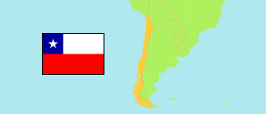
Tamarugal
Province in Tarapacá
Province
The population development of Tamarugal.
| Name | Status | Population Census 1992-04-22 | Population Census 2002-04-24 | Population Census 2017-04-19 | |
|---|---|---|---|---|---|
| Tamarugal | Province | 13,446 | 18,188 | 30,715 | → |
| Tarapacá | Region | 163,404 | 236,021 | 330,558 |
Contents: Places
The population development of the places in Tamarugal.
| Name | Status | Province | Population Census 1992-04-22 | Population Census 2002-04-24 | Population Census 2017-04-19 | |
|---|---|---|---|---|---|---|
| Baquedano | Village | Tamarugal | 400 | 410 | 587 | → |
| Camiña | Village | Tamarugal | ... | 168 | 396 | → |
| Cerro Colorado | Mining Settlement | Tamarugal | ... | ... | 631 | → |
| Collahuasi | Mining Settlement | Tamarugal | ... | ... | 3,745 | → |
| Huara | Town | Tamarugal | 427 | 956 | 1,109 | → |
| La Tirana | Village | Tamarugal | 558 | 818 | 837 | → |
| Matilla | Village | Tamarugal | ... | 361 | 380 | → |
| Nueva Victoria | Mining Settlement | Tamarugal | ... | ... | 586 | → |
| Pica | Town | Tamarugal | 1,767 | 2,642 | 3,912 | → |
| Pozo Almonte | City | Tamarugal | 3,963 | 6,384 | 10,095 | → |
| Quebrada Blanca | Mining Settlement | Tamarugal | ... | 821 | 668 | → |
| Santa Rosa | Village | Tamarugal | ... | ... | 383 | → |
Source: Instituto Nacional de Estadísticas (web).
Explanation: Boundaries of places as defined by the Instituto Nacional de Estadísticas. Population changes may result from boundary changes.