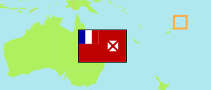
Mua
District in Wallis and Futuna
Contents: Subdivision
The population development in Mua as well as related information and services (Wikipedia, Google, images).
| Name | Status | Population Census 1990-10-09 | Population Census 1996-10-03 | Population Census 2003-07-22 | Population Census 2008-07-21 | Population Census 2013-07-22 | Population Census 2018-07-23 | Population Census 2023-07-24 | |
|---|---|---|---|---|---|---|---|---|---|
| Mua | District | 3,612 | 3,553 | 3,699 | 3,262 | 3,046 | 2,976 | 2,890 | |
| Gahi | Village | 222 | 239 | 271 | 277 | 249 | 249 | 255 | → |
| Ha'atofo | Village | 266 | 247 | 239 | 208 | 181 | 197 | 161 | → |
| Halalo | Village | 634 | 648 | 637 | 563 | 478 | 471 | 460 | → |
| Kolopopo | Village | 243 | 190 | 176 | 144 | 112 | 99 | 95 | → |
| Lavegahau | Village | 318 | 331 | 379 | 359 | 342 | 330 | 326 | → |
| Mala'efo'ou | Village | 320 | 292 | 279 | 224 | 175 | 171 | 177 | → |
| Te'esi | Village | 291 | 291 | 284 | 250 | 248 | 216 | 209 | → |
| Tepa | Village | 255 | 252 | 246 | 229 | 264 | 270 | 256 | → |
| Utufua | Village | 673 | 674 | 736 | 622 | 615 | 602 | 588 | → |
| Vaimalau | Village | 390 | 389 | 452 | 389 | 382 | 371 | 363 | → |
| Wallis-et-Futuna [Wallis and Futuna] | French Overseas Collectivity | 13,705 | 14,166 | 14,944 | 13,445 | 12,197 | 11,558 | 11,151 |
Source: Institut National de la Statistique et des Études Économiques France; Service Territorial de la Statistique et des Études Économiques, Wallis et Futuna.
Explanation: Area figures of villages are computed by using geospatial data.
Further information about the population structure:
| Gender (C 2023) | |
|---|---|
| Males | 1,396 |
| Females | 1,494 |
| Age Groups (C 2023) | |
|---|---|
| 0-14 years | 739 |
| 15-64 years | 1,746 |
| 65+ years | 405 |
| Age Distribution (C 2023) | |
|---|---|
| 80+ years | 58 |
| 70-79 years | 206 |
| 60-69 years | 281 |
| 50-59 years | 370 |
| 40-49 years | 434 |
| 30-39 years | 353 |
| 20-29 years | 246 |
| 10-19 years | 499 |
| 0-9 years | 443 |
| Citizenship (C 2023) | |
|---|---|
| France | 2,885 |
| Other Citizenship | 5 |
| Country of Birth (C 2023) | |
|---|---|
| Wallis and Futuna | 2,396 |
| New Caledonia | 273 |
| France | 146 |
| Other country | 75 |