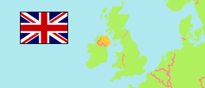
Mid and East Antrim
Local Government District in United Kingdom
Contents: Subdivision
The population development in Mid and East Antrim as well as related information and services (Wikipedia, Google, images).
| Name | Status | Population Census 2001-04-29 | Population Census 2011-03-27 | Population Census 2021-03-21 | Population Estimate 2024-06-30 | |
|---|---|---|---|---|---|---|
| Mid and East Antrim | Local Government District | 127,101 | 135,338 | 138,994 | 139,913 | |
| Ballymena | District Electoral Area | 22,035 | 22,823 | 24,295 | 24,360 | → |
| Bannside | District Electoral Area | 16,955 | 19,097 | 19,842 | 20,310 | → |
| Braid | District Electoral Area | 20,695 | 22,690 | 23,826 | 24,170 | → |
| Carrick Castle | District Electoral Area | 17,395 | 18,026 | 18,430 | 18,430 | → |
| Coast Road | District Electoral Area | 17,413 | 17,595 | 17,005 | 16,780 | → |
| Knockagh | District Electoral Area | 16,270 | 17,127 | 17,272 | 17,470 | → |
| Larne Lough | District Electoral Area | 16,684 | 17,846 | 18,324 | 18,400 | → |
| Northern Ireland | Constituent Country | 1,685,267 | 1,810,863 | 1,903,175 | 1,927,855 |
Source: The Northern Ireland Statistics and Research Agency.
Explanation: LGDs and district electoral areas as defined in 2014. Population figures for 2001 approximately correspond to this definition.
Further information about the population structure:
| Gender (C 2021) | |
|---|---|
| Males | 68,050 |
| Females | 70,944 |
| Age Groups (C 2021) | |
|---|---|
| 0-17 years | 29,235 |
| 18-64 years | 82,420 |
| 65+ years | 27,340 |
| Age Distribution (C 2021) | |
|---|---|
| 90+ years | 1,144 |
| 80-89 years | 5,960 |
| 70-79 years | 12,725 |
| 60-69 years | 16,519 |
| 50-59 years | 20,971 |
| 40-49 years | 17,659 |
| 30-39 years | 16,987 |
| 20-29 years | 14,924 |
| 10-19 years | 16,395 |
| 0-9 years | 15,711 |
| Country of Birth (C 2021) | |
|---|---|
| Northern Ireland | 122,795 |
| Great Britain | 7,156 |
| Republic of Ireland | 1,058 |
| Other country | 7,985 |
| Ethnic Group (C 2021) | |
|---|---|
| White | 135,902 |
| Other ethnic group | 3,092 |
| Religion (C 2021) | |
|---|---|
| Catholics | 24,186 |
| Church of Ireland | 15,385 |
| Presbyterians | 44,739 |
| Other Christians | 20,289 |
| Other religion | 1,191 |
| No religion | 30,502 |
| Main Language (A3+) (C 2021) | |
|---|---|
| English | 129,304 |
| Other language | 5,350 |