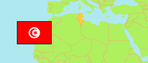
Bou Mhel El Bassatine
Municipality in Tunis Agglomeration
Contents: Subdivision
The population development in Bou Mhel El Bassatine as well as related information and services (Wikipedia, Google, images).
| Name | Status | Native | Population Census 2004-04-28 | Population Census 2014-04-23 | |
|---|---|---|---|---|---|
| Bou Mhel El Bassatine | Municipality | بومهل البساتين | 27,977 | 40,101 | |
| Bou Mhel | Sector | بومهل | 9,776 | 10,793 | → |
| Chêla | Sector | شالة | 5,279 | 6,257 | → |
| El Bassatine | Sector | البساتين | 12,922 | 13,768 | → |
| El Bassatine El Gharbya | Sector | البساتين الغربية | ... | 9,283 | → |
| Tunis | Urban Agglomeration | تونس | 2,030,683 | 2,430,294 |
Source: Institut National de la Statistique Tunisie (web).
Explanation: Municipalities in 2020 boundaries. Area figures are computed using geospatial data.