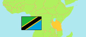
Kigoma
Region in Tanzania
Contents: Subdivision
The population development in Kigoma as well as related information and services (Wikipedia, Google, images).
| Name | Status | Population Census 1988-08-27 | Population Census 2002-08-01 | Population Census 2012-08-26 | Population Census 2022-08-23 | |
|---|---|---|---|---|---|---|
| Kigoma | Region | 856,770 | 1,674,047 | 2,127,930 | 2,470,967 | |
| Buhigwe | District | ... | ... | 254,342 | 240,005 | → |
| Kakonko | District | ... | ... | 167,555 | 178,419 | → |
| Kasulu Rural | District | ... | ... | 425,794 | 537,767 | → |
| Kasulu Town | Town | ... | ... | 208,244 | 238,321 | → |
| Kibondo | District | ... | ... | 261,331 | 362,922 | → |
| Kigoma Municipal | Municipality | 84,704 | 144,257 | 215,458 | 232,388 | → |
| Kigoma Rural | District | ... | ... | 211,566 | 222,792 | → |
| Uvinza | District | ... | ... | 383,640 | 458,353 | → |
| Tanzania | United Republic | 23,174,336 | 34,443,603 | 44,928,923 | 61,741,120 |
Source: National Bureau of Statistics Tanzania.
Explanation: Area figures of districts are calculated from geospatial data.
Further information about the population structure:
| Gender (C 2022) | |
|---|---|
| Males | 1,186,833 |
| Females | 1,284,134 |
| Urbanization (C 2022) | |
|---|---|
| Rural | 1,864,180 |
| Urban | 606,787 |
| Age Groups (C 2022) | |
|---|---|
| 0-14 years | 1,203,331 |
| 15-64 years | 1,180,350 |
| 65+ years | 87,286 |
| Age Distribution (C 2022) | |
|---|---|
| 80+ years | 25,639 |
| 70-79 years | 36,255 |
| 60-69 years | 69,835 |
| 50-59 years | 105,330 |
| 40-49 years | 168,072 |
| 30-39 years | 237,805 |
| 20-29 years | 364,189 |
| 10-19 years | 626,229 |
| 0-9 years | 837,613 |