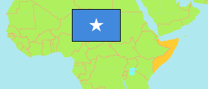
Gedo
Region in Division
Contents: Subdivision
The population development in Gedo as well as related information and services (Wikipedia, Google, images).
| Name | Status | Population Estimate 2005-08-01 | Population Estimate 2014-01-01 | Population Projection 2019-01-01 | |
|---|---|---|---|---|---|
| Gedo | Region | 328,378 | 508,405 | 566,318 | |
| Baardheere (Bardhere) | District | 106,172 | 177,384 | 151,207 | → |
| Beletxaawo (Beled Hawo) | District | 55,989 | 83,116 | 90,045 | → |
| Ceel Waaq (El Wak) | District | 19,996 | 60,046 | 50,402 | → |
| Doolow (Dolow) | District | 26,495 | 41,245 | 71,356 | → |
| Garbahaarey (Garbaharey) | District | 57,023 | 76,952 | 151,773 | → |
| Luuq | District | 62,703 | 69,660 | 51,535 | → |
| Soomaaliya [Somalia] | Federal Republic | 7,502,654 | 12,316,895 | 15,626,039 |
Source: (2005) UNDP, (2014) Population Estimation Survey 2014 by UN Population Fund, (2019) OCHA Somalia Information Management Working Group (IMWG).
Explanation: The reliability of the tabulated population figures is low. Area figures of districts are calculated by using geospatial data.
Further information about the population structure:
| Status (E 2014) | |
|---|---|
| Rural or Nomadic | 322,535 |
| Urban | 109,141 |
| Internally Displaced (IDP) | 76,728 |