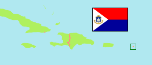
Sint Maarten is the Dutch part of St. Martin Island. It became a country of the Kingdom of the Netherlands after the Netherlands Antilles were disbanded in 2010.
Country
The population development of Sint Maarten according to census results.
| Name | Abbr. | Capital | Area A (km²) | Population Census (C) 1981-02-01 | Population Census (C) 1992-01-27 | Population Census (C) 2001-01-29 | Population Census (C) 2011-04-09 | Population Census (C) 2022-11-11 | ||
|---|---|---|---|---|---|---|---|---|---|---|
| Sint Maarten | Philipsburg | 34 | 13,156 | 32,221 | 30,594 | 33,609 | 41,901 | 3400 | ||
| Sint Maarten | SXM | Philipsburg | 34 | 13,156 | 32,221 | 30,594 | 33,609 | 41,901 |
- (1981) Encyclopedie van Curaçao.
(1992) The Statesman's Year-Book '95/96.
(2001) Central Bureau of Statistics, Netherlands Antilles.
(2011) (2022) Department of Statistics Sint Maarten.
Contents: Settlements
The population of the settlements on Sint Maarten according to census results and latest official estimates.
| Name | Population Census (C) 2001-01-29 | Population Estimate (E) 2017-01-01 | Area |
|---|---|---|---|
| Cole Bay | 6,046 | 7,194 | 0 |
| Cul de Sac | 7,880 | 8,588 | 0 |
| Little Bay | 2,176 | 5,581 | 0 |
| Lower Prince's Quarter | 8,123 | 10,833 | 0 |
| Low Lands | 232 | 708 | 0 |
| Philipsburg | 1,227 | 1,894 | 0 |
| Simpson Bay | 736 | 1,142 | 0 |
| Upper Prince's Quarter | 4,021 | 4,595 | 0 |
- The 2001 figures do not include 153 persons with no reported place of residence.
- (2001) Central Bureau of Statistics, Netherlands Antilles.
(2017) Department of Statistics Sint Maarten.
