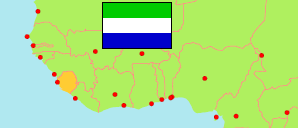
Moyamba
District in Sierra Leone
Contents: Subdivision
The population development in Moyamba as well as related information and services (Wikipedia, Google, images).
| Name | Status | Population Census 2004-12-04 | Population Census 2015-12-04 | Population Census 2021-12-09 | |
|---|---|---|---|---|---|
| Moyamba | District | 260,910 | 318,588 | 346,771 | |
| Bagruwa | Chiefdom | 18,989 | 27,623 | 28,311 | → |
| Bumpeh | Chiefdom | 32,363 | 37,445 | 38,740 | → |
| Dasse | Chiefdom | 10,879 | 13,217 | 13,451 | → |
| Fakunya | Chiefdom | 22,327 | 27,646 | 26,948 | → |
| Kagboro | Chiefdom | 31,150 | 34,862 | 39,341 | → |
| Kaiyamba | Chiefdom | 21,669 | 25,749 | 28,636 | → |
| Kamajei | Chiefdom | 8,549 | 10,165 | 11,289 | → |
| Kongbora | Chiefdom | 11,331 | 10,328 | 11,866 | → |
| Kori | Chiefdom | 29,043 | 30,514 | 33,895 | → |
| Kowa | Chiefdom | 7,082 | 9,752 | 10,207 | → |
| Lower Banta | Chiefdom | 25,954 | 37,317 | 45,837 | → |
| Ribbi | Chiefdom | 25,163 | 33,165 | 32,690 | → |
| Timdale | Chiefdom | 8,192 | 10,292 | 13,468 | → |
| Upper Banta | Chiefdom | 8,219 | 10,513 | 12,092 | → |
| Sierra Leone | Republic | 4,976,871 | 7,092,113 | 7,548,702 |
Source: Statistics Sierra Leone (web).
Explanation: Boundaries of districts and chiefdoms according to the administrative reorganization of 2017. The 2021 census is a mid-term census. The reasons for the significant differences between the 2015 and 2021 figures are unclear. Area figures are derived from geospatial data.