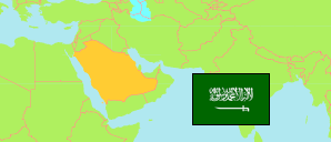
Saudi Arabia: Ḥā'il Region
Governorates
The population of the governorates (muḥafaẓat) in Ḥā'il Region by census years.
| Name | Native | Status | Population Census 2004-09-15 | Population Census 2010-04-28 | Population Census 2022-05-10 | |
|---|---|---|---|---|---|---|
| Al-Ghazalah | الغزالة | Governorate | ... | ... | 12,767 | → |
| Al-Ḥā'īṭ [← Al-Ghazalah] | الحائط | Governorate | ... | ... | 74,596 | → |
| Ash-Shamlī [← Ḥā'il] | الشملي | Governorate | ... | ... | 20,946 | → |
| Ash-Shanān | الشنان | Governorate | ... | ... | 29,419 | → |
| As-Sulaymī [← Al-Ghazalah] | السليمي | Governorate | ... | ... | 17,343 | → |
| Baq'ā' [Baqaa ] | بقعاء | Governorate | 38,875 | 40,211 | 56,362 | → |
| Ḥā'il [Ha'il] | حائل | Governorate | 356,770 | 417,869 | 498,575 | → |
| Mawqaq [← Ḥā'il] | موقق | Governorate | ... | ... | 16,835 | → |
| Simīrā' [← Ḥā'il] | سميراء | Governorate | ... | ... | 19,563 | → |
| Ḥā'il | حائل | Region | 526,882 | 605,930 | 746,406 |
Contents: Places
The population of all places with at least 2500 inhabitants in Ḥā'il Region by census years.
| Name | Native | Status | Governorat | Population Census 2004-09-15 | Population Census 2010-04-28 | Population Census 2022-05-10 | |
|---|---|---|---|---|---|---|---|
| Al-Ajfir | الاجفر | Place | Baq'ā' | 2,996 | ... | 7,518 | → |
| Al-Ghazālah | الغزالة | Place | Al-Ghazalah | 3,271 | ... | 5,592 | → |
| Al-Ḥafīr | الحفير | Place | Mawqaq | 3,041 | ... | 3,243 | → |
| Al-Ḥā'īṭ [Al-Ha'et] | الحائط | Place | Al-Ḥā'īṭ | 6,376 | 7,125 | 8,289 | → |
| Al-Ḥalīfah as-Suflā | الحليفة السفلى | Place | Al-Ḥā'īṭ | 2,979 | ... | 4,151 | → |
| Al-Khuṭah | الخطة | Place | Ḥā'il | 862 | ... | 3,355 | → |
| Al-Qā'id [Al-Qaidah] | القاعـد | Place | Ḥā'il | 4,710 | 5,523 | 2,913 | → |
| An-Nayṣīh | النيصية | Place | Ḥā'il | 1,010 | ... | 4,597 | → |
| Ar-Rarwḍah | الروضة | Place | Ḥā'il | 3,460 | ... | 2,906 | → |
| Ash-Shamly | الشملى | Place | Ash-Shamlī | 2,833 | ... | 9,163 | → |
| Ash-Shanān | الشنان | Place | Ash-Shanān | 6,141 | 7,157 | 11,560 | → |
| Baq'ā' [Baqaa ] | بقعاء | Place | Baq'ā' | 11,815 | 13,382 | 19,659 | → |
| Ḥā'il [Ha'il] | حائل | Place | Ḥā'il | 267,133 | 310,897 | 448,623 | → |
| Jubah [Jobaah] | جبة | Place | Ḥā'il | 4,984 | 5,493 | 5,622 | → |
| Mawqaq | موقق | Place | Mawqaq | 4,170 | ... | 3,148 | → |
| Munīfat al-Qā'id | منيفة القاعد | Place | Ḥā'il | ... | ... | 4,688 | → |
| Simīrā' | سميراء | Place | Simīrā' | 2,592 | ... | 3,105 | → |
| Turubah | تربة | Place | Baq'ā' | 4,699 | 5,134 | 8,590 | → |
Source: General Statistics Authority, Kingdom of Saudi Arabia (web).
Explanation: Population changes are partly result of boundary changes. Area figures are computed by using geospatial data.