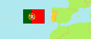
Caldas da Rainha
Municipality in Leiria District
Contents: Subdivision
The population development in Caldas da Rainha as well as related information and services (Wikipedia, Google, images).
| Name | Status | Population Census 2001-03-12 | Population Census 2011-03-21 | Population Census 2021-03-22 | |
|---|---|---|---|---|---|
| Caldas da Rainha | Municipality | 48,846 | 51,729 | 50,910 | |
| A dos Francos | Parish | 1,797 | 1,701 | 1,632 | → |
| Alvorninha | Parish | 3,123 | 2,987 | 2,646 | → |
| Caldas da Rainha - Nossa Senhora do Pópulo, Coto e São Gregório | Parish | 16,495 | 18,417 | 18,540 | → |
| Caldas da Rainha - Santo Onofre e Serra do Bouro | Parish | 11,495 | 11,926 | 11,902 | → |
| Carvalhal Benfeito | Parish | 1,339 | 1,279 | 1,141 | → |
| Foz do Arelho | Parish | 1,223 | 1,339 | 1,400 | → |
| Landal | Parish | 1,144 | 1,051 | 938 | → |
| Nadadouro | Parish | 1,422 | 1,904 | 1,962 | → |
| Salir de Matos | Parish | 2,428 | 2,583 | 2,583 | → |
| Santa Catarina | Parish | 3,282 | 3,029 | 2,692 | → |
| Tornada e Salir do Porto | Parish | 3,920 | 4,358 | 4,434 | → |
| Vidais | Parish | 1,178 | 1,155 | 1,040 | → |
| Leiria | District | 459,426 | 470,922 | 458,605 |
Source: Instituto Nacional de Estatística Portugal (web).
Further information about the population structure:
| Gender (C 2021) | |
|---|---|
| Males | 23,998 |
| Females | 26,912 |
| Age Groups (C 2021) | |
|---|---|
| 0-14 years | 6,166 |
| 15-64 years | 31,653 |
| 65+ years | 13,091 |
| Age Distribution (C 2021) | |
|---|---|
| 80+ years | 4,057 |
| 70-79 years | 5,567 |
| 60-69 years | 7,185 |
| 50-59 years | 7,420 |
| 40-49 years | 7,287 |
| 30-39 years | 5,433 |
| 20-29 years | 5,177 |
| 10-19 years | 4,932 |
| 0-9 years | 3,852 |
| Citizenship (C 2021) | |
|---|---|
| Portugal | 47,238 |
| EU | 815 |
| Europe (other) | 769 |
| Africa | 318 |
| America | 1,546 |
| Asia & Oceania | 222 |
| Country of Birth (C 2021) | |
|---|---|
| Portugal | 44,447 |
| EU | 1,359 |
| Europe (other) | 1,119 |
| Africa | 1,632 |
| America | 2,048 |
| Asia & Oceania | 305 |