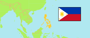
Pampanga
Province in Luzon
Contents: Subdivision
The population development in Pampanga as well as related information and services (Wikipedia, Google, images).
| Name | Status | Population Census 1990-05-01 | Population Census 2000-05-01 | Population Census 2010-05-01 | Population Census 2015-08-01 | Population Census 2020-05-01 | Population Census 2024-07-01 | |
|---|---|---|---|---|---|---|---|---|
| Pampanga (incl. City of Angeles) | Province | 1,532,615 | 1,882,730 | 2,340,355 | 2,609,744 | 2,900,637 | 3,069,898 | |
| Angeles | City | 236,685 | 267,788 | 326,336 | 411,634 | 462,928 | 483,452 | → |
| Apalit | Municipality | 62,373 | 78,295 | 101,537 | 107,965 | 117,160 | 121,057 | → |
| Arayat | Municipality | 73,189 | 101,792 | 121,348 | 133,492 | 144,875 | 150,949 | → |
| Bacolor | Municipality | 67,259 | 16,147 | 31,508 | 39,460 | 48,066 | 59,361 | → |
| Candaba | Municipality | 68,145 | 86,066 | 102,399 | 111,586 | 119,497 | 124,019 | → |
| Floridablanca | Municipality | 66,146 | 85,394 | 110,846 | 125,163 | 135,542 | 146,095 | → |
| Guagua | Municipality | 88,290 | 97,632 | 111,199 | 117,430 | 128,893 | 137,948 | → |
| Lubao | Municipality | 99,705 | 125,699 | 150,843 | 160,838 | 173,502 | 190,355 | → |
| Mabalacat | City | 121,115 | 171,045 | 215,610 | 250,799 | 293,244 | 306,594 | → |
| Macabebe | Municipality | 55,505 | 65,346 | 70,777 | 75,850 | 78,151 | 82,933 | → |
| Magalang | Municipality | 43,940 | 77,530 | 103,597 | 113,147 | 124,188 | 133,883 | → |
| Masantol | Municipality | 41,964 | 48,120 | 52,407 | 57,063 | 57,990 | 57,207 | → |
| Mexico | Municipality | 69,441 | 109,481 | 146,851 | 154,624 | 173,403 | 187,597 | → |
| Minalin | Municipality | 34,795 | 35,150 | 44,001 | 47,713 | 48,380 | 50,126 | → |
| Porac | Municipality | 68,215 | 80,757 | 111,441 | 124,381 | 140,751 | 147,551 | → |
| San Fernando | City | 157,851 | 221,857 | 285,912 | 306,659 | 354,666 | 377,534 | → |
| San Luis | Municipality | 31,920 | 41,554 | 49,311 | 54,106 | 58,551 | 64,674 | → |
| San Simon | Municipality | 30,851 | 41,253 | 48,353 | 53,198 | 59,182 | 65,760 | → |
| Santa Ana | Municipality | 32,540 | 42,990 | 52,001 | 55,178 | 61,537 | 63,431 | → |
| Santa Rita | Municipality | 28,296 | 32,780 | 38,762 | 40,979 | 48,209 | 42,915 | → |
| Santo Tomas | Municipality | 33,309 | 32,695 | 38,062 | 40,475 | 42,846 | 44,376 | → |
| Sasmuan (Sexmoan) | Municipality | 21,148 | 23,359 | 27,254 | 28,004 | 29,076 | 32,081 | → |
| Luzon | Island Group | 33,357,887 | 42,822,878 | 52,362,999 | 57,470,097 | 62,196,942 | 64,162,977 |
Source: Philippines Statistics Authority.
Explanation: Area figures are computed by using geospatial data.
Further information about the population structure:
| Gender (C 2020) | |
|---|---|
| Males | 1,466,965 |
| Females | 1,427,344 |
| Age Groups (C 2020) | |
|---|---|
| 0-14 years | 832,102 |
| 15-64 years | 1,908,194 |
| 65+ years | 154,013 |
| Age Distribution (C 2020) | |
|---|---|
| 80+ years | 24,165 |
| 70-79 years | 67,688 |
| 60-69 years | 151,689 |
| 50-59 years | 250,899 |
| 40-49 years | 336,527 |
| 30-39 years | 422,116 |
| 20-29 years | 536,956 |
| 10-19 years | 549,097 |
| 0-9 years | 555,172 |