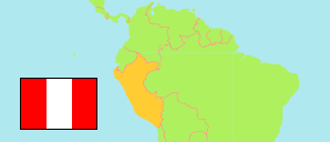
Amotape
District in Piura Region
Contents: Population
The population development of Amotape as well as related information and services (Wikipedia, Google, images).
| Name | Status | Population Census 1993-07-11 | Population Census 2007-10-21 | Population Census 2017-10-22 | Population Projection 2022-06-30 | |
|---|---|---|---|---|---|---|
| Amotape | District | 2,222 | 2,305 | 2,437 | 2,565 | |
| Piura | Region | 1,388,264 | 1,676,315 | 1,929,970 | 2,103,099 |
Source: Instituto Nacional de Estadística e Informática, Peru (web).
Explanation: The tabulated results of the 2017 census are adjusted for underenumeration. Area figures are computed by using geospatial data.
Further information about the population structure:
| Gender (C 2017) | |
|---|---|
| Males | 1,267 |
| Females | 1,170 |
| Age Groups (C 2017) | |
|---|---|
| 0-14 years | 649 |
| 15-64 years | 1,521 |
| 65+ years | 267 |
| Age Distribution (C 2017) | |
|---|---|
| 90+ years | 13 |
| 80-89 years | 64 |
| 70-79 years | 112 |
| 60-69 years | 190 |
| 50-59 years | 244 |
| 40-49 years | 263 |
| 30-39 years | 356 |
| 20-29 years | 388 |
| 10-19 years | 352 |
| 0-9 years | 455 |
| Urbanization (C 2017) | |
|---|---|
| Rural | 77 |
| Urban | 2,360 |
| Literacy (A3+) (C 2017) | |
|---|---|
| yes | 2,018 |
| no | 283 |
| Ethnic Group (A12+) (C 2017) | |
|---|---|
| Quechua | 2 |
| Afro-Peruvian | 62 |
| White | 57 |
| Mestizo | 1,769 |
| Religion (A12+) (C 2017) | |
|---|---|
| Catholic | 1,669 |
| Evangelical | 195 |
| Other religion | 16 |
| No religion | 26 |