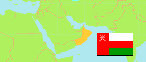
Bawshar
District in Muscat Governorate
District
The population development of Bawshar.
| Name | Native | Status | Population Census 2003-12-07 | Population Census 2010-12-12 | Population Census 2020-12-12 | |
|---|---|---|---|---|---|---|
| Bawshar | بوشر | District | 150,420 | 192,235 | 382,184 | → |
| Masqaṭ [Muscat] | مسقط | Governorate | 632,073 | 775,878 | 1,302,440 |
Contents: Localities
The population development of the localities in Bawshar.
| Name | Native | Status | District | Population Census 2003-12-07 | Population Census 2010-12-12 | Population Census 2020-12-12 | |
|---|---|---|---|---|---|---|---|
| Al-Aqbiyah | العقبية | Locality | Bawshar | 121 | 66 | 69 | → |
| Al-Hammam | الحمام | Locality | Bawshar | 314 | 310 | 302 | → |
| Al-Misfah al-Gharbiyah | المسفاة الغربية | Locality | Bawshar | 372 | 423 | 784 | → |
| Al-Misfah ash-Sharqiyah | المسفاة الشرقية | Locality | Bawshar | 266 | 390 | 448 | → |
| As-Suwaydifi | السويديفي | Locality | Bawshar | 116 | 1,559 | 12,822 | → |
| Bawshar | بوشر | Locality | Bawshar | 148,335 | 187,871 | 362,523 | → |
| Falaj ash-Sham | فلج الشام | Locality | Bawshar | 463 | 967 | 4,361 | → |
| Sunub | صنب | Locality | Bawshar | 433 | 493 | 833 | → |
Source: Sultanate of Oman, National Centre for Statistics and Information (web).
Explanation: The 2020 census was organized as an electronic census.