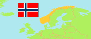
Hareid
Municipality in Møre og Romsdal County
Municipality
The population development of Hareid.
| Name | Status | Population Estimate 2000-01-01 | Population Estimate 2006-01-01 | Population Estimate 2013-01-01 | Population Estimate 2020-01-01 | Population Estimate 2025-01-01 | |
|---|---|---|---|---|---|---|---|
| Hareid | Municipality | 4,748 | 4,637 | 5,057 | 5,175 | 5,320 | → |
| Møre og Romsdal | County | 240,439 | 242,403 | 256,975 | 265,238 | 272,413 |
Contents: Settlements
The population development of the settlements in Hareid.
| Name | Status | Municipality | Population Estimate 2000-01-01 | Population Estimate 2006-01-01 | Population Estimate 2013-01-01 | Population Estimate 2020-01-01 | Population Estimate 2025-01-01 | |
|---|---|---|---|---|---|---|---|---|
| Brandal | Settlement | Hareid | 323 | 313 | 346 | 356 | 320 | → |
| Hareid | Settlement | Hareid | ... | ... | 3,245 | 3,437 | 3,648 | → |
| Hjørungavåg (← Hareid) | Settlement | Hareid | ... | ... | 748 | 715 | 708 | → |
Source: Statistics Norway.
Explanation: Urban settlements in the boundaries of 2025.