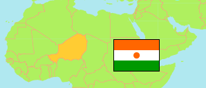
Kantché
Department in Niger
Contents: Subdivision
The population development in Kantché as well as related information and services (Wikipedia, Google, images).
| Name | Status | Population Census 2001-05-20 | Population Census 2012-12-10 | |
|---|---|---|---|---|
| Kantché (Matameye) | Department | 246,496 | 399,181 | |
| Dan-Barto | Commune | 28,911 | 40,900 | → |
| Daouché | Commune | 25,162 | 37,754 | → |
| Doungou | Commune | 22,879 | 39,031 | → |
| Ichirnawa | Commune | 24,993 | 42,582 | → |
| Kantché | Commune | 36,608 | 56,468 | → |
| Kourni | Commune | 20,411 | 28,872 | → |
| Matamèye | Commune | 41,382 | 64,988 | → |
| Tsaouni | Commune | 21,357 | 37,854 | → |
| Yaouri | Commune | 24,793 | 50,732 | → |
| Niger | Republic | 11,060,291 | 17,138,707 |
Source: Institut National de la Statistique du Niger (web).
Explanation: Area figures are computed by using geospatial data.