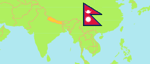
Jumla
District in Nepal
Contents: Subdivision
The population development in Jumla as well as related information and services (Wikipedia, Google, images).
| Name | Status | Transcription | Native | Population Census 2001-05-28 | Population Census 2011-06-22 | Population Census 2021-11-25 | |
|---|---|---|---|---|---|---|---|
| Jumla | District | Jumlā | जुम्ला जिल्ला | 89,427 | 108,921 | 118,349 | |
| Chandannath | Municipality | Candananātha | चन्दननाथ नगरपालिका | ... | 20,371 | 21,036 | → |
| Guthichaur | Rural Municipality | Guṭhicaura | गुठिचौर गाउँपालिका | 5,353 | 9,920 | 10,922 | → |
| Hima | Rural Municipality | Himā | हिमा गाउँपालिका | 4,933 | 10,553 | 12,191 | → |
| Kankasundari | Rural Municipality | Kanakāsundarī | कनकासुन्दरी गाउँपालिका | 8,419 | 13,216 | 13,625 | → |
| Patarasi | Rural Municipality | Pātārāsī | पातारासी गाउँपालिका | 11,400 | 14,608 | 16,824 | → |
| Sinja | Rural Municipality | Siñjā | सिंजा गाउँपालिका | 4,765 | 12,008 | 12,556 | → |
| Tatopani | Rural Municipality | Tātōpānī | तातोपानी गाउँपालिका | 11,208 | 14,638 | 15,575 | → |
| Tila | Rural Municipality | Tilā | तिला गाउँपालिका | 11,431 | 13,607 | 14,539 | → |
| Nepal | Federal Republic | Nēpāla | नेपाल | 23,151,423 | 26,494,504 | 29,164,578 |
Source: Central Bureau of Statistics Nepal (web).
Explanation: The local units became operational in May 2017. The 2021 population of local units exclude institional population.
Further information about the population structure:
| Gender (C 2021) | |
|---|---|
| Males | 59,228 |
| Females | 59,121 |
| Age Groups (C 2021) | |
|---|---|
| 0-14 years | 37,919 |
| 15-64 years | 75,580 |
| 65+ years | 4,850 |
| Age Distribution (C 2021) | |
|---|---|
| 90+ years | 62 |
| 80-89 years | 303 |
| 70-79 years | 2,526 |
| 60-69 years | 5,220 |
| 50-59 years | 8,548 |
| 40-49 years | 11,625 |
| 30-39 years | 15,465 |
| 20-29 years | 22,678 |
| 10-19 years | 28,641 |
| 0-9 years | 23,281 |
| Citizenhip (C 2021) | |
|---|---|
| Nepal | 118,306 |
| India | 40 |
| Other country | 3 |
| Place of Birth (C 2021) | |
|---|---|
| Same local unit | 104,606 |
| Other local unit in same district | 8,396 |
| Other district | 5,216 |
| Other country | 96 |
| Literacy (A5+) (C 2021) | |
|---|---|
| Yes | 75,564 |
| Only reading | 746 |
| No | 30,888 |