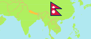
Lalitpur
District in Nepal
Contents: Subdivision
The population development in Lalitpur as well as related information and services (Wikipedia, Google, images).
| Name | Status | Transcription | Native | Population Census 2001-05-28 | Population Census 2011-06-22 | Population Census 2021-11-25 | |
|---|---|---|---|---|---|---|---|
| Lalitpur | District | Lalitapura | ललितपुर जिल्ला | 337,785 | 468,132 | 551,667 | |
| Bagmati | Rural Municipality | Bāgamatī | बागमती गाउँपालिका | 14,155 | 13,049 | 11,353 | → |
| Godawari | Municipality | Gōdāvarī | गोदावरी नगरपालिका | 66,240 | 80,376 | 97,633 | → |
| Konjyosom | Rural Municipality | Kōnjyōsōma | कोन्ज्योसोम गाउँपालिका | 9,871 | 9,709 | 8,989 | → |
| Lalitpur | Metropolis | Lalitapura | ललितपुर महानगरपालिका | 200,020 | 292,848 | 294,098 | → |
| Mahalaxmi | Municipality | Mahālakṣmī | महालक्ष्मी नगरपालिका | 35,802 | 62,624 | 123,116 | → |
| Mahankal | Rural Municipality | Mahāṅkāla | महाङ्काल गाउँपालिका | 10,539 | 9,526 | 8,122 | → |
| Nepal | Federal Republic | Nēpāla | नेपाल | 23,151,423 | 26,494,504 | 29,164,578 |
Source: Central Bureau of Statistics Nepal (web).
Explanation: The local units became operational in May 2017. The 2021 population of local units exclude institional population.
Further information about the population structure:
| Gender (C 2021) | |
|---|---|
| Males | 277,131 |
| Females | 274,536 |
| Age Groups (C 2021) | |
|---|---|
| 0-14 years | 106,410 |
| 15-64 years | 407,627 |
| 65+ years | 37,630 |
| Age Distribution (C 2021) | |
|---|---|
| 90+ years | 1,094 |
| 80-89 years | 5,769 |
| 70-79 years | 17,001 |
| 60-69 years | 32,287 |
| 50-59 years | 55,428 |
| 40-49 years | 79,067 |
| 30-39 years | 97,169 |
| 20-29 years | 108,425 |
| 10-19 years | 88,934 |
| 0-9 years | 66,493 |
| Citizenhip (C 2021) | |
|---|---|
| Nepal | 545,861 |
| India | 4,822 |
| Other country | 984 |
| Place of Birth (C 2021) | |
|---|---|
| Same local unit | 258,240 |
| Other local unit in same district | 32,800 |
| Other district | 250,652 |
| Other country | 9,849 |
| Literacy (A5+) (C 2021) | |
|---|---|
| Yes | 459,140 |
| Only reading | 938 |
| No | 61,174 |