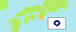
Prefecture
The population development of Wakayama Prefecture according to census results.
| Name | Abbr. | Status | Native | Capital | Area A-L (km²) | Population Census (Cf) 1995-10-01 | Population Census (Cf) 2000-10-01 | Population Census (Cf) 2005-10-01 | Population Census (Cf) 2010-10-01 | Population Census (Cf) 2015-10-01 | Population Census (Cf) 2020-10-01 | |||
|---|---|---|---|---|---|---|---|---|---|---|---|---|---|---|
| Japan | JPN | 日本国 | Tōkyō | 377,976 | 125,570,246 | 126,925,843 | 127,767,994 | 128,057,352 | 127,094,745 | 126,146,099 | → | |||
| Wakayama | 30 | Pref | 和歌山県 | Wakayama | 4,725 | 1,080,435 | 1,069,912 | 1,035,969 | 1,002,198 | 963,579 | 922,584 | 472500 | → |
- Statistics Bureau Japan (web).
Major Cities
| Name | Population Census (Cf) 2020-10-01 | |
|---|---|---|
| 1 | Wakayama | 356,729 |
| 2 | Tanabe | 69,870 |
| 3 | Hashimoto | 60,818 |
| 4 | Kinokawa | 58,816 |
| 5 | Iwade | 53,967 |
| 6 | Kainan | 48,369 |
| 7 | Shingū | 27,171 |
| 8 | Arida | 26,538 |
| 9 | Aridagawa | 25,258 |
Contents: Cities & Towns
The population of all cities and towns of Wakayama Prefecture with more than 20,000 inhabitants according to census results.
| Name | Status | Native | Population Census (Cf) 1995-10-01 | Population Census (Cf) 2000-10-01 | Population Census (Cf) 2005-10-01 | Population Census (Cf) 2010-10-01 | Population Census (Cf) 2015-10-01 | Population Census (Cf) 2020-10-01 | Area | ||
|---|---|---|---|---|---|---|---|---|---|---|---|
| Arida | City | 有田市 | 34,283 | 33,661 | 32,143 | 30,592 | 28,470 | 26,538 | 3683 | → | |
| Aridagawa (Kibi) | Town | 有田川町 | 29,703 | 29,563 | 28,640 | 27,162 | 26,361 | 25,258 | 35184 | → | |
| Gobō | City | 御坊市 | 28,510 | 28,034 | 27,053 | 26,111 | 24,801 | 23,481 | 4391 | → | |
| Hashimoto | City | 橋本市 | 69,329 | 70,469 | 68,529 | 66,361 | 63,621 | 60,818 | 13055 | → | |
| Iwade | City | 岩出市 | 41,550 | 48,156 | 50,834 | 52,882 | 53,452 | 53,967 | 3851 | → | |
| Kainan | City | 海南市 | 62,634 | 60,373 | 57,744 | 54,783 | 51,860 | 48,369 | 10106 | → | |
| Katsuragi | Town | かつらぎ町 | 22,052 | 20,945 | 19,670 | 18,230 | 16,992 | 15,967 | 15169 | → | |
| Kinokawa (Kishigawa) | City | 紀の川市 | 68,802 | 70,067 | 67,862 | 65,840 | 62,616 | 58,816 | 22821 | → | |
| Kushimoto | Town | 串本町 | 22,521 | 21,429 | 19,931 | 18,249 | 16,558 | 14,959 | 13567 | → | |
| Shingū | City | 新宮市 | 36,278 | 35,176 | 33,790 | 31,498 | 29,331 | 27,171 | 25523 | → | |
| Shirahama | Town | 白浜町 | 24,916 | 24,563 | 23,642 | 22,696 | 21,533 | 20,262 | 20098 | → | |
| Tanabe | City | 田辺市 | 86,159 | 85,646 | 82,499 | 79,119 | 74,770 | 69,870 | 102691 | → | |
| Wakayama | City | 和歌山市 | 393,885 | 386,551 | 375,591 | 370,364 | 364,154 | 356,729 | 20885 | → |
- Statistics Bureau Japan (web).
