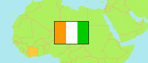
Gôh
Region in Ivory Coast
Contents: Subdivision
The population development in Gôh as well as related information and services (Wikipedia, Google, images).
| Name | Status | Population Census 2014-05-15 | Population Census 2021-12-14 | |
|---|---|---|---|---|
| Gôh | Region | 876,117 | 985,282 | |
| Bayota | Sub-Prefecture | 54,125 | 54,139 | → |
| Dahiépa-Kéhi | Sub-Prefecture | 18,173 | 20,827 | → |
| Diégonéfla | Sub-Prefecture | 75,167 | 74,076 | → |
| Dignago | Sub-Prefecture | 32,387 | 35,712 | → |
| Dougroupalégnoa | Sub-Prefecture | 47,083 | 58,655 | → |
| Doukouyo | Sub-Prefecture | 21,361 | 18,867 | → |
| Gagnoa | Sub-Prefecture | 213,918 | 277,044 | → |
| Galébré-Galébouo | Sub-Prefecture | 33,269 | 38,550 | → |
| Gnagbodougnoa | Sub-Prefecture | 9,981 | 17,196 | → |
| Guépahouo | Sub-Prefecture | 33,798 | 28,007 | → |
| Guibéroua | Sub-Prefecture | 64,284 | 77,669 | → |
| Oumé | Sub-Prefecture | 127,850 | 127,153 | → |
| Ouragahio | Sub-Prefecture | 36,364 | 50,150 | → |
| Sérihio | Sub-Prefecture | 42,545 | 46,320 | → |
| Tonla | Sub-Prefecture | 37,205 | 31,550 | → |
| Yopohué | Sub-Prefecture | 28,607 | 29,367 | → |
| Côte d'Ivoire [Ivory Coast] | Republic | 22,671,331 | 29,389,150 |
Source: Institut National de la Statistique, Republique de Côte d'Ivoire (web).
Explanation: Area figures are derived from geospatial data.