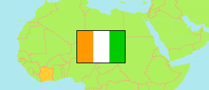
Indénié-Djuablin
Region in Ivory Coast
Contents: Subdivision
The population development in Indénié-Djuablin as well as related information and services (Wikipedia, Google, images).
| Name | Status | Population Census 2014-05-15 | Population Census 2021-12-14 | |
|---|---|---|---|---|
| Indénié-Djuablin | Region | 560,432 | 716,443 | |
| Abengourou | Sub-Prefecture | 135,635 | 164,424 | → |
| Agnibilékrou | Sub-Prefecture | 69,174 | 99,501 | → |
| Akoboissué | Sub-Prefecture | 28,647 | 36,022 | → |
| Amélékia | Sub-Prefecture | 25,238 | 25,387 | → |
| Aniassué | Sub-Prefecture | 40,498 | 42,729 | → |
| Bettié | Sub-Prefecture | 24,983 | 33,020 | → |
| Damé | Sub-Prefecture | 15,920 | 23,691 | → |
| Diamarakro | Sub-Prefecture | 31,113 | 36,621 | → |
| Duffrébo | Sub-Prefecture | 42,426 | 44,107 | → |
| Ebilassokro | Sub-Prefecture | 19,433 | 28,331 | → |
| Niablé | Sub-Prefecture | 44,967 | 57,081 | → |
| Tanguélan | Sub-Prefecture | 12,021 | 12,944 | → |
| Yakassé-Féyassé | Sub-Prefecture | 36,838 | 52,445 | → |
| Zaranou | Sub-Prefecture | 33,539 | 60,142 | → |
| Côte d'Ivoire [Ivory Coast] | Republic | 22,671,331 | 29,389,150 |
Source: Institut National de la Statistique, Republique de Côte d'Ivoire (web).
Explanation: Area figures are derived from geospatial data.