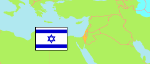
Haifa District 1 (0112)
Residential Area (jewish) in Haifa Metropolitan Area
Contents: Population
The population development of Haifa District 1 (0112) as well as related information and services (Wikipedia, Google, images).
| Name | Status | Native | Population Estimate 2013-12-31 | Population Estimate 2017-12-31 | Population Estimate 2021-12-31 | |
|---|---|---|---|---|---|---|
| Haifa District 1 (0112) [Kiryat Shmuel] | Residential Area (jewish) | חיפה רובע 1 - קריית שמואל 0112 | 5,320 | 5,687 | 5,970 | |
| Hefa [Haifa] | Metropolitan Area | חיפה | 583,210 | 610,028 | 637,956 |
Source: Central Bureau of Statistics, The State of Israel.
Further information about the population structure:
| Gender (E 2021) | |
|---|---|
| Males | 2,885 |
| Females | 3,085 |
| Age Groups (E 2021) | |
|---|---|
| 0-14 years | 2,037 |
| 15-64 years | 3,100 |
| 65+ years | 833 |
| Age Distribution (E 2021) | |
|---|---|
| 80+ years | 247 |
| 70-79 years | 375 |
| 60-69 years | 424 |
| 50-59 years | 415 |
| 40-49 years | 639 |
| 30-39 years | 698 |
| 20-29 years | 626 |
| 10-19 years | 1,196 |
| 0-9 years | 1,350 |
| Ethnic Group (E 2021) | |
|---|---|
| Jews & Others | 5,970 |