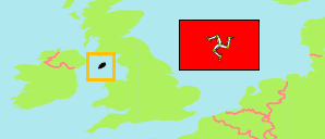
Santon
Parish in Isle of Man
Contents: Population
The population development of Santon as well as related information and services (Wikipedia, Google, images).
| Name | Status | Population Census 1981-04-05 | Population Census 1986-04-06 | Population Census 1996-04-14 | Population Census 2001-04-29 | Population Census 2006-04-23 | Population Census 2011-03-27 | Population Census 2016-04-24 | Population Census 2021-05-30 | |
|---|---|---|---|---|---|---|---|---|---|---|
| Santon | Parish | 427 | 427 | 422 | 580 | 680 | 691 | 700 | 749 | |
| Isle of Man (Mannin) | Crown Dependency | 64,679 | 64,282 | 71,714 | 76,315 | 80,058 | 84,497 | 83,314 | 84,069 |
Source: Isle of Man Government (web), UN Demographic Yearbook.
Further information about the population structure:
| Gender (C 2021) | |
|---|---|
| Males | 344 |
| Females | 405 |
| Age Groups (C 2021) | |
|---|---|
| 0-14 years | 117 |
| 15-64 years | 495 |
| 65+ years | 137 |
| Age Distribution (C 2021) | |
|---|---|
| 0-9 years | 75 |
| 10-19 years | 85 |
| 20-29 years | 89 |
| 30-39 years | 83 |
| 40-49 years | 96 |
| 50-59 years | 137 |
| 60-69 years | 87 |
| 70-79 years | 64 |
| 80+ years | 33 |