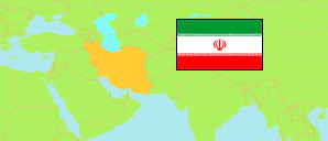
Khorāsān-e Shomali
Province in Iran
Contents: Subdivision
The population development in Khorāsān-e Shomali as well as related information and services (Wikipedia, Google, images).
| Name | Status | Native | Population Census 2011-10-24 | Population Census 2016-09-24 | |
|---|---|---|---|---|---|
| Khorāsān-e Shomali [North Khorasan] | Province | خراسان شمالی | 867,727 | 863,092 | |
| Bojnūrd [Bojnord] | County | شهرستان بجنورد | 306,862 | 324,083 | → |
| Esfarāyen | County | شهرستان اسفراین | 127,012 | 120,513 | → |
| Fārūj | County | شهرستان فاروج | 52,364 | 49,271 | → |
| Garmeh | County | شهرستان گرمه | 24,599 | 25,475 | → |
| Jājarm | County | شهرستان جاجرم | 36,898 | 36,673 | → |
| Māneh va Samalqān | County | شهرستان مانه وسملقان | 103,944 | 101,727 | → |
| Rāz va Jargalān [← Bojnūrd] | County | شهرستان رازوجرگلان | 59,034 | 59,210 | → |
| Shīrvān | County | شهرستان شیروان | 157,014 | 146,140 | → |
| Iran | Islamic Republic | ایران | 75,149,669 | 79,926,270 |
Source: Statistical Centre of Iran (web).
Explanation: Area figures of counties are derived from geospatial data.
Further information about the population structure:
| Gender (C 2016) | |
|---|---|
| Males | 433,633 |
| Females | 429,459 |
| Age Groups (C 2016) | |
|---|---|
| 0-14 years | 235,908 |
| 15-64 years | 579,949 |
| 65+ years | 47,235 |
| Age Distribution (C 2016) | |
|---|---|
| 90+ years | 788 |
| 80-89 years | 8,696 |
| 70-79 years | 21,529 |
| 60-69 years | 42,350 |
| 50-59 years | 74,290 |
| 40-49 years | 101,676 |
| 30-39 years | 151,963 |
| 20-29 years | 158,928 |
| 10-19 years | 135,601 |
| 0-9 years | 167,271 |
| Urbanization (C 2016) | |
|---|---|
| Rural | 377,533 |
| Urban | 484,346 |
| Literacy (A6+) (C 2016) | |
|---|---|
| yes | 632,333 |
| no | 126,749 |