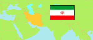
Kohkīlūyeh va Boyer Ahmadī
Province in Iran
Contents: Subdivision
The population development in Kohkīlūyeh va Boyer Ahmadī as well as related information and services (Wikipedia, Google, images).
| Name | Status | Native | Population Census 2011-10-24 | Population Census 2016-09-24 | |
|---|---|---|---|---|---|
| Kohkīlūyeh va Boyer Ahmadī [Kohgiluyeh and Boyer-Ahmad] | Province | کهگیلویه و بویراحمد | 658,629 | 713,052 | |
| Bahmaī | County | شهرستان بهمئی | 37,048 | 38,136 | → |
| Bāsht | County | شهرستان باشت | 20,699 | 21,690 | → |
| Būyerāḥmad [Boyer-Ahmad] | County | شهرستان بویراحمد | 252,746 | 299,885 | → |
| Chorām | County | شهرستان چرام | 32,159 | 33,543 | → |
| Danā | County | شهرستان دنا | 43,065 | 42,539 | → |
| Gachsārān | County | شهرستان گچساران | 119,217 | 124,096 | → |
| Kohgīlūyeh | County | شهرستان کهگیلویه | 132,328 | 131,351 | → |
| Landeh [← Kohgīlūyeh] | County | شهرستان لنده | 21,367 | 21,812 | → |
| Iran | Islamic Republic | ایران | 75,149,669 | 79,926,270 |
Source: Statistical Centre of Iran (web).
Explanation: Area figures of counties are derived from geospatial data.
Further information about the population structure:
| Gender (C 2016) | |
|---|---|
| Males | 361,386 |
| Females | 351,666 |
| Age Groups (C 2016) | |
|---|---|
| 0-14 years | 195,247 |
| 15-64 years | 484,959 |
| 65+ years | 32,846 |
| Age Distribution (C 2016) | |
|---|---|
| 90+ years | 784 |
| 80-89 years | 8,296 |
| 70-79 years | 13,112 |
| 60-69 years | 28,710 |
| 50-59 years | 51,103 |
| 40-49 years | 84,821 |
| 30-39 years | 133,326 |
| 20-29 years | 146,522 |
| 10-19 years | 106,592 |
| 0-9 years | 139,786 |
| Urbanization (C 2016) | |
|---|---|
| Rural | 314,009 |
| Urban | 397,461 |
| Literacy (A6+) (C 2016) | |
|---|---|
| yes | 527,688 |
| no | 97,729 |