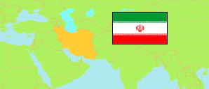
Markazī
Province in Iran
Contents: Subdivision
The population development in Markazī as well as related information and services (Wikipedia, Google, images).
| Name | Status | Native | Population Census 2011-10-24 | Population Census 2016-09-24 | |
|---|---|---|---|---|---|
| Markazī | Province | مرکزی | 1,413,959 | 1,429,475 | |
| Arāk | County | شهرستان اراک | 599,634 | 591,756 | → |
| Āshtīān | County | شهرستان آشتیان | 17,105 | 16,357 | → |
| Delījān | County | شهرستان دلیجان | 48,986 | 51,621 | → |
| Farāhān | County | شهرستان فراهان | 30,042 | 28,994 | → |
| Khomeyn | County | شهرستان خمین | 107,368 | 105,017 | → |
| Khondāb | County | شهرستان خنداب | 58,262 | 54,018 | → |
| Komījān | County | شهرستان کمیجان | 39,340 | 36,441 | → |
| Maḥalāt [Mahallat] | County | شهرستان محلات | 53,381 | 55,342 | → |
| Sāveh | County | شهرستان ساوه | 259,030 | 283,538 | → |
| Shāzand | County | شهرستان شازند | 117,746 | 117,571 | → |
| Tafresh | County | شهرستان تفرش | 25,912 | 24,913 | → |
| Zarandīeh | County | شهرستان زرندیه | 57,153 | 63,907 | → |
| Iran | Islamic Republic | ایران | 75,149,669 | 79,926,270 |
Source: Statistical Centre of Iran (web).
Explanation: Area figures of counties are derived from geospatial data.
Further information about the population structure:
| Gender (C 2016) | |
|---|---|
| Males | 725,751 |
| Females | 703,724 |
| Age Groups (C 2016) | |
|---|---|
| 0-14 years | 311,897 |
| 15-64 years | 1,009,494 |
| 65+ years | 108,084 |
| Age Distribution (C 2016) | |
|---|---|
| 90+ years | 3,711 |
| 80-89 years | 24,086 |
| 70-79 years | 47,923 |
| 60-69 years | 79,975 |
| 50-59 years | 139,429 |
| 40-49 years | 197,606 |
| 30-39 years | 278,473 |
| 20-29 years | 253,912 |
| 10-19 years | 187,980 |
| 0-9 years | 216,380 |
| Urbanization (C 2016) | |
|---|---|
| Rural | 329,690 |
| Urban | 1,099,764 |
| Literacy (A6+) (C 2016) | |
|---|---|
| yes | 1,127,151 |
| no | 168,194 |