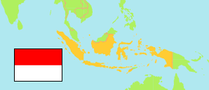
Kolaka Timur
Regency in Indonesia
Contents: Population
The population development of Kolaka Timur as well as related information and services (Wikipedia, Google, images).
| Name | Status | Population Census 2005-06-30 | Population Census 2010-05-01 | Population Census 2015-05-01 | Population Census 2020-09-15 | |
|---|---|---|---|---|---|---|
| Kolaka Timur (Koltim) [East Kolaka] | Regency | ... | 106,415 | 177,667 | 120,699 | |
| Indonesia | Republic | 218,868,791 | 237,641,326 | 255,182,144 | 270,203,917 |
Source: Badan Pusat Statistik, Republik Indonesia (web).
Explanation: 2005 and 2015 figures are result of an intermediate census.
Further information about the population structure:
| Gender (C 2020) | |
|---|---|
| Males | 62,064 |
| Females | 58,635 |
| Age Groups (C 2020) | |
|---|---|
| 0-14 years | 30,957 |
| 15-59 years | 84,008 |
| 65+ years | 5,734 |
| Age Distribution (C 2020) | |
|---|---|
| 90+ years | 32 |
| 80-89 years | 536 |
| 70-79 years | 2,558 |
| 60-69 years | 6,224 |
| 50-59 years | 11,966 |
| 40-49 years | 17,637 |
| 30-39 years | 18,764 |
| 20-29 years | 20,667 |
| 10-19 years | 22,016 |
| 0-9 years | 20,299 |