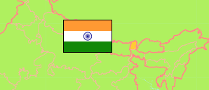
Sikkim was a monarchy under Indian protectorate. In 1975, it became an Indian state.
State
The population development of the State of Sikkim by census years.
| Name | Abbr. | Status | Capital | Area A (km²) | Population Census (Cf) 1981-03-01 | Population Census (Cf) 1991-03-01 | Population Census (Cf) 2001-03-01 | Population Census (Cf) 2011-03-01 | Population Projection (P) 2023-03-01 | |||
|---|---|---|---|---|---|---|---|---|---|---|---|---|
| India | IND | Rep | New Delhi | 3,166,620 | 685,184,692 | 846,387,888 | 1,028,737,436 | 1,210,854,977 | 1,387,284,900 | → | ||
| Sikkim | SIK | St | Gangtok | 7,096 | 316,385 | 406,457 | 540,851 | 610,577 | 689,000 | 709600 | → |
- Office of the Registrar General and Census Commissioner.
(2023) National Commission on Population (adapted by Unique Identification Authority of India).
Contents: Cities & Towns
The population development of all cities and towns in Sikkim with more than 10,000 inhabitants by census years.
| Name | Status | Population Census (Cf) 1991-03-01 | Population Census (Cf) 2001-03-01 | Population Census (Cf) 2011-03-01 | Area | ||
|---|---|---|---|---|---|---|---|
| Gangtok (incl. Upper Tādong) | City | 25,024 | 43,711 | 100,286 | 0 | → | |
| Jorethang | Town | 1,939 | 2,967 | 9,009 | 0 | → | |
| Namchi | City | 630 | 979 | 12,190 | 0 | → | |
| Rangpo | Town | 2,980 | 3,709 | 10,450 | 0 | → |
- (2001) (2011) Office of the Registrar General and Census Commissioner, Delimitation Commission of India, Population Census India.
