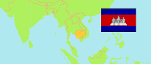
Kang Meas
District in Cambodia
Contents: Subdivision
The population development in Kang Meas as well as related information and services (Wikipedia, Google, images).
| Name | Status | Native | Population Census 1998-03-03 | Population Census 2008-03-03 | Population Census 2019-03-03 | |
|---|---|---|---|---|---|---|
| Kang Meas | District | កងមាស | 91,212 | 89,727 | 85,488 | |
| Angkor Ban | Rural Commune | អង្គរបាន | 9,366 | 8,606 | 7,651 | → |
| Kang Ta Noeng | Rural Commune | កងតាណឹង | 8,415 | 8,388 | 9,915 | → |
| Khchau | Rural Commune | ខ្ចៅ | 9,409 | 9,081 | 8,711 | → |
| Peam Chi Kang | Rural Commune | ពាមជីកង | 7,449 | 6,770 | 6,210 | → |
| Preaek Koy | Rural Commune | ព្រែកកុយ | 8,387 | 9,110 | 8,614 | → |
| Preaek Krabau | Rural Commune | ព្រែកក្របៅ | 7,417 | 7,538 | 7,860 | → |
| Reay Pay | Rural Commune | រាយប៉ាយ | 8,794 | 10,145 | 8,937 | → |
| Roka Ar | Rural Commune | រកាអារ | 7,381 | 7,170 | 6,924 | → |
| Roka Koy | Rural Commune | រកាគយ | 8,970 | 8,504 | 7,116 | → |
| Sdau | Rural Commune | ស្ដៅ | 5,239 | 5,012 | 4,906 | → |
| Sour Kong | Rural Commune | សូរគង | 10,385 | 9,403 | 8,644 | → |
| Kâmpŭchéa [Cambodia] | Kingdom | កម្ពុជា | 11,437,656 | 13,395,682 | 15,552,211 |
Source: National Institute of Statistics of Cambodia (web)
Explanation: The result of the 2019 census represents the de facto population of Cambodia. It excludes about 1.235 million migrants working abroad. The 2019 figures for districts and communes refer only to household population; they exclude institutional, boat and transient population, i.e. 2.36% of the total population is missing in addition. A reclassification of urban areas was undertaken in 2020. Because of missing data, the status of communes has been partly adapted, yet.