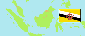
Labi
Mukim in Belait District
Contents: Subdivision
The population development in Labi as well as related information and services (Wikipedia, Google, images).
| Name | Status | Population Census 2011-06-20 | Population Census 2016-05-01 | Population Census 2021-04-20 | |
|---|---|---|---|---|---|
| Labi | Mukim | 916 | 1,216 | 727 | |
| Kampung Bukit Puan | Village | 138 | 182 | 122 | → |
| Kampung Gatas | Village | 66 | 73 | 47 | → |
| Kampung Kenapol | Village | 83 | 84 | 59 | → |
| Kampung Labi | Village | 38 | 28 | 22 | → |
| Kampung Labi Lama | Village | 7 | 11 | 4 | → |
| Kampung Mendaram Kecil | Village | 77 | 114 | 58 | → |
| Kampung Rampayoh | Village | 105 | 183 | 65 | → |
| Kampung Ratan | Village | 55 | 91 | 57 | → |
| Kampung Simpang Tiga | Village | 0 | 0 | 0 | → |
| Kampung Sungai Petai | Village | 77 | 93 | 110 | → |
| Kampung Tanajor | Village | 113 | 142 | 80 | → |
| Kampung Tapang Lupak | Village | 9 | 33 | 25 | → |
| Kampung Teraja | Village | 23 | 35 | 16 | → |
| Kampung Terawan | Village | 39 | 74 | 43 | → |
| Kampung Terunan | Village | 86 | 73 | 19 | → |
| Belait | District | 60,744 | 69,062 | 65,531 |
Source: Department of Economic Planning and Development, Brunei (web).
Explanation: Area figures are computed by using geospatial data. Urban/rural categorization according to 2016 census.
Further information about the population structure:
| Gender (C 2021) | |
|---|---|
| Males | 419 |
| Females | 308 |
| Age Groups (C 2021) | |
|---|---|
| 0-14 years | 89 |
| 15-64 years | 507 |
| 65+ years | 131 |
| Citizenship (C 2021) | |
|---|---|
| Brunei | 320 |
| Permanent Resident Foreigners | 226 |
| Temporary Resident Foreigners | 181 |
| Urbanization (C 2021) | |
|---|---|
| Rural | 727 |