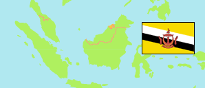
Kuala Balai
Mukim in Belait District
Contents: Subdivision
The population development in Kuala Balai as well as related information and services (Wikipedia, Google, images).
| Name | Status | Population Census 2011-06-20 | Population Census 2016-05-01 | Population Census 2021-04-20 | |
|---|---|---|---|---|---|
| Kuala Balai | Mukim | 15 | 31 | 16 | |
| Hutan Simpan Kuala Balai | Forest | 0 | 0 | 0 | → |
| Kampung Kajitan | Village | 0 | 0 | 0 | → |
| Kampung Kuala Balai | Village | 0 | 0 | 0 | → |
| Kampung Lubok Lanyap | Village | 0 | 0 | 0 | → |
| Kampung Lubok Tapang | Village | 0 | 0 | 0 | → |
| Kampung Pangalayan | Village | 0 | 0 | 0 | → |
| Kampung Penyarap | Village | 0 | 0 | 0 | → |
| Kampung Sungai Damit | Village | 0 | 0 | 0 | → |
| Kampung Sungai Lutong | Village | 0 | 0 | 0 | → |
| Kampung Sungai Mendaram | Village | 0 | 0 | 0 | → |
| Kampung Tanjong Rangas | Village | 15 | 31 | 16 | → |
| Kampung Tanjong Sudai | Village | 0 | 0 | 0 | → |
| Kampung Tugong | Village | 0 | 0 | 0 | → |
| Belait | District | 60,744 | 69,062 | 65,531 |
Source: Department of Economic Planning and Development, Brunei (web).
Explanation: Area figures are computed by using geospatial data. Urban/rural categorization according to 2016 census.
Further information about the population structure:
| Gender (C 2021) | |
|---|---|
| Males | 5 |
| Females | 11 |
| Age Groups (C 2021) | |
|---|---|
| 0-14 years | 2 |
| 15-64 years | 13 |
| 65+ years | 1 |
| Citizenship (C 2021) | |
|---|---|
| Brunei | 8 |
| Permanent Resident Foreigners | 6 |
| Temporary Resident Foreigners | 2 |