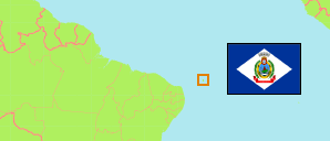
The archipelago was a federal district until 1988 and belongs now to the State of Pernambuco.
State District
The population development of Fernando de Noronha according to census results.
Fernando de Noronha is completely urban.
| Name | Abbr. | Status | Capital | Area A (km²) | Population Census (Cf) 1991-09-01 | Population Census (Cf) 2000-08-01 | Population Census (Cf) 2010-08-01 | Population Census (C) 2022-08-01 | ||
|---|---|---|---|---|---|---|---|---|---|---|
| Fernando de Noronha | FN | Dist | 17 | 1,686 | 2,051 | 2,630 | 3,167 | 1700 | → | |
| Brazil | BRA | Fed Rep | Brasília | 8,510,418 | 146,825,475 | 169,799,170 | 190,755,799 | 203,080,756 |
- Instituto Brasileiro de Geografia e Estatistica.
Population Structure
Further information about the population structure.
| Gender (C 2022) | |
|---|---|
| Males | 1,651 |
| Females | 1,516 |
| Age Groups (C 2022) | |
|---|---|
| 0-14 years | 459 |
| 15-64 years | 2,553 |
| 65+ years | 155 |
| Age Distribution (C 2022) | |
|---|---|
| 90+ years | 7 |
| 80-89 years | 28 |
| 70-79 years | 58 |
| 60-69 years | 198 |
| 50-59 years | 409 |
| 40-49 years | 559 |
| 30-39 years | 713 |
| 20-29 years | 609 |
| 10-19 years | 264 |
| 0-9 years | 322 |
| Ethnic Group (C 2022) | |
|---|---|
| Indigenous | 9 |
| Non-Indigenous | 3,158 |
| Color (C 2022) | |
|---|---|
| Black | 447 |
| White | 1,080 |
| Mixed / Other | 1,640 |
| Literacy (A15+) (C 2022) | |
|---|---|
| yes | 2,613 |
| no | 95 |
