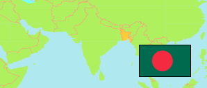
Faridpur
District in Bangladesh
Contents: Subdivision
The population development in Faridpur as well as related information and services (Wikipedia, Google, images).
| Name | Status | Transcription | Native | Population Census 1991-03-13 | Population Census 2001-01-22 | Population Census 2011-03-15 | Population Census 2022-06-14 | |
|---|---|---|---|---|---|---|---|---|
| Faridpur | District | Pharidapura | ফরিদপুর জেলা | 1,505,686 | 1,756,470 | 1,912,969 | 2,162,879 | |
| Alfadanga | Subdistrict | Ālaphāḍāṅā | আলফাডাঙা উপজেলা | 90,873 | 100,598 | 108,302 | 119,625 | → |
| Bhanga | Subdistrict | Bhāṅgā | ভাঙ্গা উপজেলা | 214,702 | 232,386 | 259,032 | 293,835 | → |
| Boalmari | Subdistrict | Bōẏālamārī | বোয়ালমারী উপজেলা | 190,159 | 233,683 | 256,658 | 268,146 | → |
| Charbhadrasan | Subdistrict | Carabhadrāsana | চরভদ্রাসন উপজেলা | 69,876 | 76,366 | 63,477 | 70,920 | → |
| Faridpur Sadar | Subdistrict | Pharidapura Sadara | ফরিদপুর সদর উপজেলা | 335,386 | 413,485 | 469,410 | 567,621 | → |
| Madhukhali | Subdistrict | Madhukhālī | মধুখালী উপজেলা | 165,438 | 187,775 | 204,492 | 231,974 | → |
| Nagarkanda | Subdistrict | Nagarakāndā | নগরকান্দা উপজেলা | ... | ... | 197,898 | 222,925 | → |
| Sadarpur | Subdistrict | Sadarapura | সদরপুর উপজেলা | 172,059 | 188,757 | 186,254 | 201,494 | → |
| Saltha [← Nagarkanda] | Subdistrict | Sālathā | সালথা উপজেলা | ... | ... | 167,446 | 186,214 | → |
| Bangladesh | People's Republic | Bā̃lādēśa | বাংলাদেশ | 106,314,992 | 124,355,263 | 144,043,697 | 165,158,616 |
Source: Bangladesh Bureau of Statistics.
Explanation: The tabulated figures are not adjusted for underenumeration. 2022 subdistrict figures exclude hijra. Some area figures are derived from geospatial data.